24 August 2026 • 10 min read
Pico Island has 14 official marked trails. The terrain ranges from easy coastal walks through the UNESCO-listed vineyard landscape to medium mountain descents from the central highlands. Pico Mountain, the island's main summit, has a separate dedicated guide.
Top picks: PR5PIC Vinhas da Criação Velha | PR13PIC Lagoa do Capitão | PRC11PIC Calheta do Nesquim
Best season: May to October | Difficulty range: Easy to Hard | Permit required: Pico Mountain only
Hiking on Pico Island
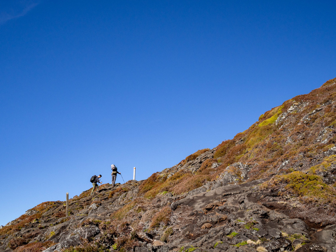
Pico is the second largest island in the Azores and one of the most varied in terms of terrain. The western half is dominated by the volcanic cone of Pico Mountain (2,351m), the highest point in Portugal. The eastern half extends as a long volcanic ridge with roughly 200 smaller cones, a plateau scattered with lakes and bogs, and a coastline broken by lava fields, tidal pools, and fishing villages.
The 14 official trails cover all of this. Some descend from the central highlands to the coast, passing through dense native forest along the way. Others follow the UNESCO-listed vineyard landscape at sea level, tracing centuries-old paths cut into the basalt. A few explore the historic lava fields, locally called mistérios, left by eruptions in the 18th century.
Pico Mountain has its own extensive guide at Hiking Pico Mountain: Complete Climbing Guide. This article covers the island's other official trails.
PR5PIC Vinhas da Criação Velha ⭐
Easy · 7 km · 2 hours · Linear · Candelária to Areia Larga
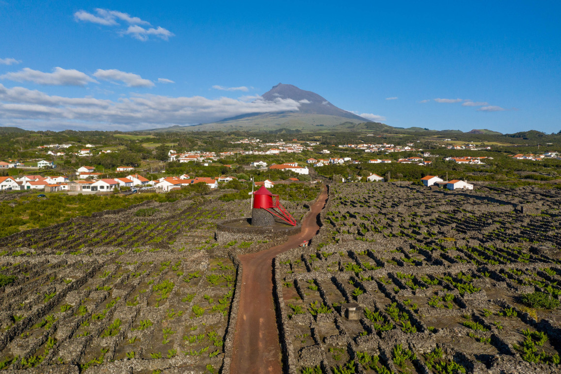
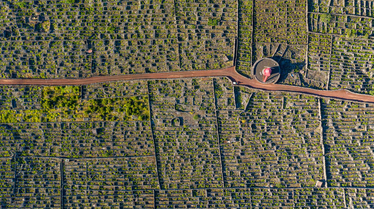
This is the island's most culturally distinctive trail. It runs through the Criação Velha vineyard landscape, classified as UNESCO World Heritage since 2004, an area where grapes have been grown inside low basalt-wall enclosures for centuries.
The route begins at Porto do Calhau in the village of Candelária and follows the coastline westward to Areia Larga in the municipality of Madalena. Almost entirely at sea level, the elevation profile is nearly flat, making it accessible to most walkers.
Along the way, the trail passes tidal wells (called poços de maré), used historically to collect brackish water for irrigation and domestic use. The relheiras, grooves worn into the lava rock by ox-cart wheels, are visible in several sections. The rola-pipas, carved stone ramps used to slide wine barrels down to boats, appear near the coast. The trail also passes Laja das Rosas, a bathing area with natural pools, and the rebuilt Moinho do Frade windmill. It ends near the Ancoradouro restaurant at Porto da Areia Larga.
The BootsnAll travel platform recognized this trail in 2011 for its scenic and cultural value. Of all the trails on the island, it gives the clearest picture of how people have lived and worked on the Pico coast for the past four centuries.
PR13PIC Lagoa do Capitão ⭐
Medium · 9.3 km · 3 hours · Linear · Estrada Transversal to Cais do Pico
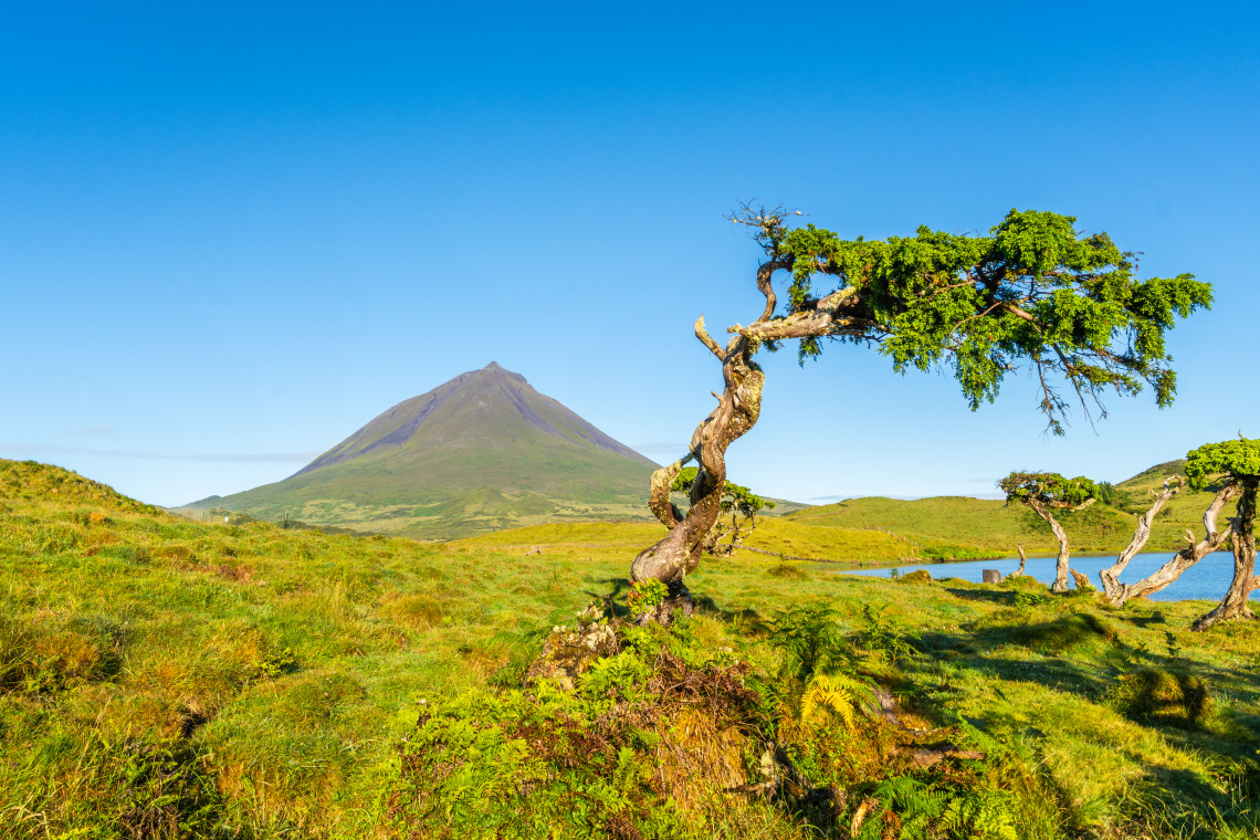
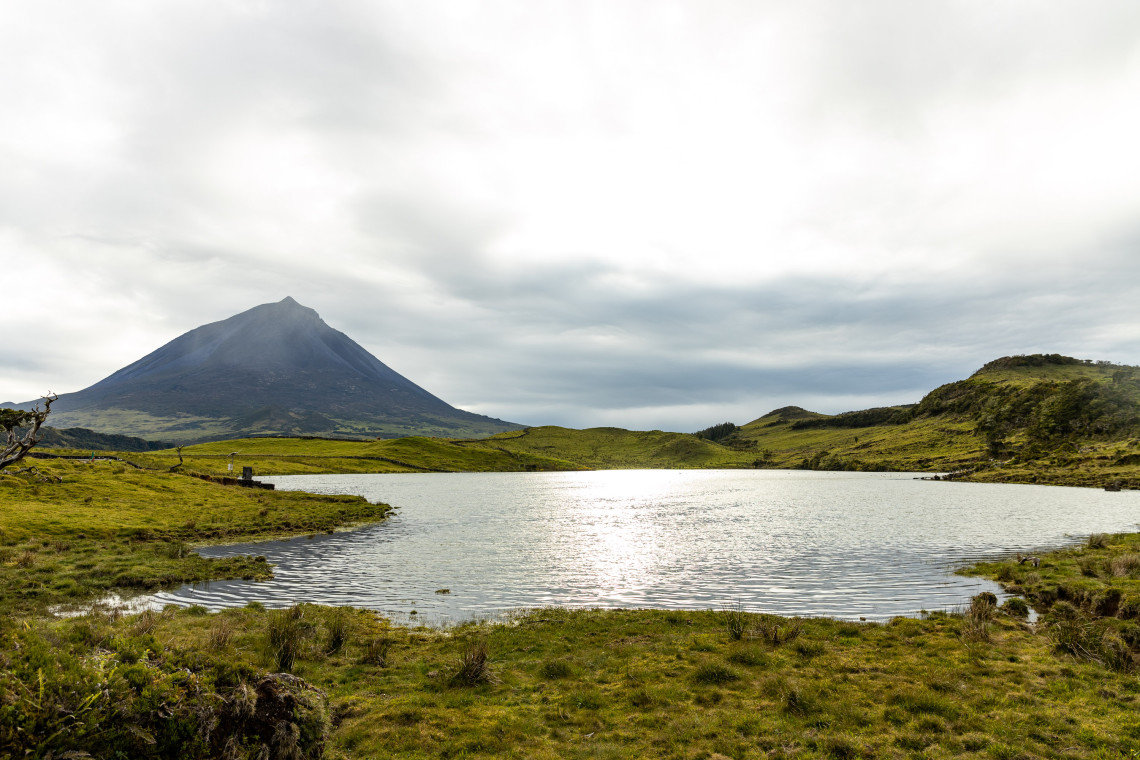
Lagoa do Capitão is the best trail on Pico for combining highland altitude, native forest, and a descent to the coast in a single route. It starts near the Estrada Transversal (the main cross-island road) at around 766 meters, visits the lake, and descends all the way to Cais do Pico on the northern coast.
From the lake, the trail takes a dirt path flanked by some of the largest Azores juniper trees (Juniperus brevifolia) on the island. After roughly 3 km, it skirts the base of Piquinho, the secondary cone inside Pico's main crater. On clear days, the views over the north coast from this stretch are substantial. The descent then steepens along a cobbled path, passing through Australian cheesewood and then into open farmland near the coast. The trail ends at the Convento de São Pedro de Alcântara.
This route is classified as medium difficulty. The main challenge is the sustained descent over uneven terrain in the lower section. The start point requires transport as it is not within walking distance of the main towns.
PRC11PIC Calheta do Nesquim ⭐
Medium · 9.1 km · 3 hours · Circular · Calheta do Nesquim
Calheta do Nesquim is a small village on the south coast with one of the strongest whaling histories on the island. The trail begins and ends at the harbour, in front of the 1852 Church of São Sebastião. Before starting, the House of Whaling Boats next to the harbour is worth visiting.
The route heads east along the coast to the Feteira harbour, a small bay with access to natural swimming pools. It then climbs inland, reaching elevations above 300 meters before the descent through forested land. A whale-watching tower along the descent provides views over the south coast. The trail returns to sea level at Poça das Mujas, the most remote of Pico's official bathing areas, where the Windmill of Morro do Cão (also known as Murricão) stands.
This is the only circular trail among Pico's main routes, which makes logistics simpler. There is no need to arrange return transport. The rating from over 325 visitors makes it the most consistently reviewed trail on the island.
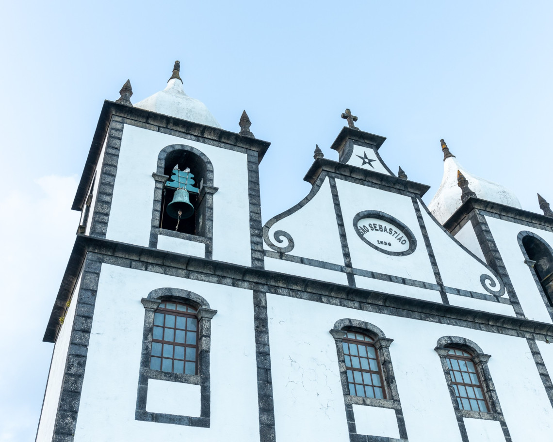
PR15PIC Mistérios do Sul do Pico
Easy · 8.5 km · 3 hours · Linear · Mistério de São João to Silveira
This trail is the most direct way to walk through Pico's historic lava fields. The word mistério, meaning mystery, was the name locals gave to the sudden eruptions they witnessed without being able to explain them. The Mistério de São João and Mistério da Silveira, the two lava fields this trail passes through, resulted from eruptions in 1718 and 1720. The solidified lava remains largely intact, and the vegetation growing through it is visibly different from the surrounding farmland.
The trail starts at the Forest Reserve and Recreation Park of Mistério de São João and runs along the south coast to the parish of Silveira. It passes four tidal wells (at Baía do Arruda, Ponta do Admoiro, Verdoso, and Maré do Rego), the 1949 Ponta Rasa windmill, classified as a Property of Municipal Interest, and the small museum Casa do Pico, which documents the life of traditional island families. Natural swimming areas at Ponta do Admoiro, Arinhas, and Fonte are accessible directly from the trail.
Despite covering significant distance, the flat coastal terrain keeps this in the easy category. It works well as a standalone day hike or combined with a swim at one of the pools.
PR1PIC Caminhos de Santa Luzia
Medium · 9.4 km · 3 hours · Linear/Circular · Miraguaia to Santa Luzia
This trail begins at Miraguaia, in the Santa Luzia area, with a descent through the UNESCO-protected vineyard landscape to the Lajido coastline. The path follows the same basalt-walled terrain as Vinhas da Criação Velha but approaches it from a different direction, including a section where ox-cart track marks are pressed into the lava rock. The small museum at Lajido documents the vineyard culture. The trail then climbs back through Forno dos Frades and up to the main regional road, before entering a second section through native forest of Picconia azorica, Azorean heather, and incense tree. This second section is circular and returns to the Church of Santa Luzia.
The combination of coastal vineyard and native forest in one route makes it one of the more varied walks on the island.
PR10PIC Santana-Lajido
Easy · 8.7 km · 2h 30min · Linear · Santana to Lajido
The trail starts at the border of Santana and São Vicente Ferreira on the north coast. A short detour at the start leads to a whale lookout post, where it is worth stopping on clear days. The main route descends to Gasparal Bay through orchards and vineyards, passes a tidal pool, and continues along the basaltic coast to Ponta Negra. After passing through the villages of Cabrito and Arcos and the Ermida de São Mateus chapel, the trail ends at the Interpretation Centre for the UNESCO Pico Wine Landscape at Lajido.
This is one of the gentler trails on the island, suitable for walkers who want a low-effort coastal route with access to the vineyard landscape. Ending at the Lajido Interpretation Centre gives useful context for what the vineyard walls and structures mean.
PR3PIC Ponta da Ilha
Hard · 6.1 km · 3 hours · Linear · Eastern tip of the island
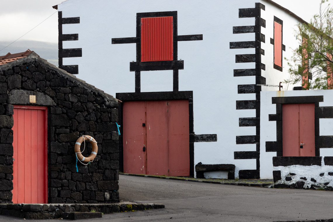
The eastern tip of Pico is the island's most remote hiking terrain. This trail starts at the far eastern end of the island, passing the 1854 Chapel of Our Lady of the Rock (Ermida de Nossa Senhora de Cima da Rocha) before dropping onto a coastal path over raw basaltic rock. The surface is uneven and requires attention. The trail passes vineyards and old stone houses, then climbs to the houses of Engrade before reaching the Manhenha Lighthouse. The route ends at the Quay of Manhenha.
Despite the relatively short distance, the hard classification reflects the rough surface of the coastal section. This is not a trail for anyone unfamiliar with uneven volcanic terrain. For experienced hikers, the isolation and raw coastal scenery at the eastern tip are the reward.
More Highland Routes
Two long trails cover the central highlands in depth. The PR2PIC Caminho dos Burros: Vertente Norte (8.9 km, Medium, 3h30) descends from the highlands near the Estrada Transversal to the Bay of Canas on the north coast, passing through dense endemic vegetation including Euphorbia stygiana and extensive Sphagnum moss. The variant to São Miguel Arcanjo adds a further 3 km.
The Caminho das Lagoas (22 km, 7 hours) is the island's longest trail, crossing the full length of the highland plateau from the Estrada Transversal to Ribeirinha. It passes four named lakes, Caiado, Lagoa Seca, Lagoas do Peixinho, and Lagoa do Paúl, and goes through the Caveiro Nature Reserve, an area of endemic cedars, heathers, and sanguinho. On clear days, São Jorge and Terceira are visible from the ridge. This trail is not recommended in fog, which settles frequently at altitude.
BOOK A GUIDED HIKE ON PICO
Browse guided hiking tours and outdoor activities on Pico Island, led by local guides with knowledge of the trails, flora, and volcanic history.
View Pico Activities →When to Hike on Pico Island
May to October is the main hiking season. July and August offer the most stable weather and the longest daylight. The mountain trails and highland routes are more reliably clear of cloud in summer, though fog can descend at altitude without warning at any time of year.
The coastal trails (Vinhas da Criação Velha, Santana-Lajido, Mistérios do Sul) can be walked year-round. They are mostly at sea level and are less affected by weather than the highland routes. Spring (April-May) brings green vegetation and wildflowers along the coastal paths.
The Caminho das Lagoas should only be attempted in clear conditions. Visibility drops quickly in the highland plateau and the trail markings are harder to follow in fog.
Pico Mountain requires a registration at the mountain house and is best attempted May to September, ideally starting before sunrise for summit conditions. See the full mountain guide for details.
Practical Tips
Trail markings use the standard Portuguese system: yellow and red marks indicate the correct route, yellow and black marks signal a wrong turn. Most trails on Pico are well marked, though the highland routes require more attention.
Transport is a real constraint on Pico. Most linear trails end in a different location from where they start, and public transport between villages is limited. Hiring a car or arranging pick-up with a local operator is the practical solution for most of the island's trails.
Footwear matters on the lava trails. The basalt is sharp and uneven. Hiking boots with ankle support are better suited to PR3PIC Ponta da Ilha and the coastal sections than trail runners.
Water. There are no reliable water sources on the trails. Carry what you need. In summer, the exposed coastal routes can be warm.
Trail leaflets with GPS tracks and maps are available as free downloads for each route at trails.visitazores.com. Download the GPX file before leaving your accommodation, as mobile signal is unreliable in the highlands.
Plan Your Pico Island Trip
Combine hiking with the UNESCO vineyard coast, whale watching, and the lava tube at Gruta das Torres. Our local team can build an itinerary around your trails and dates.
Keep reading
Frequently Asked Questions
Do I need a permit to hike on Pico Island?
A permit is required to climb Pico Mountain. Registration is done at the mountain house (Casa da Montanha) and there are limits on daily climbers. All other official trails on the island are free to walk with no permit or prior registration required.
What is the easiest hiking trail on Pico Island?
PR5PIC Vinhas da Criação Velha (7 km, 2 hours) is the most accessible trail on the island. It is almost entirely flat, follows the UNESCO vineyard coast at sea level, and requires no technical skill. PR10PIC Santana-Lajido (8.7 km, 2h30) is another easy option with a gentle coastal route to the Lajido Interpretation Centre.
What is the most scenic hiking trail on Pico Island (other than Pico Mountain)?
PR13PIC Lagoa do Capitão offers the most varied scenery: highland altitude, native Azores juniper forest, views over the north coast from near Piquinho, and a descent to the coast. For cultural scenery, PR5PIC Vinhas da Criação Velha through the UNESCO vineyard landscape is unmatched.
Are the hiking trails on Pico Island well marked?
Most trails use the standard Portuguese yellow-and-red marking system. Coastal trails are generally well marked. Highland trails, particularly the Caminho das Lagoas, require more attention and should not be attempted in low visibility.
How do I get between the start and end of linear trails on Pico Island?
Public transport on Pico is limited. Most visitors hire a car and arrange a drop-off at the trailhead, or book a guided hiking tour that includes transport logistics. PRC11PIC Calheta do Nesquim is the main exception, as it is a circular trail that starts and ends in the same place.
When is the best time to hike on Pico Island?
May to October is the main season. July and August offer the most stable conditions for highland trails. Coastal routes like Vinhas da Criação Velha and Mistérios do Sul can be walked year-round, though spring brings the most varied wildflowers. Avoid the highland plateau trails in fog.
Can I do multiple trails in one day on Pico Island?
Yes, though logistics matter. The coastal trails in the Madalena area (PR5PIC and PR10PIC) are geographically close and could be combined with a car. The highland trails are long enough that most visitors do one per day. The 22 km Caminho das Lagoas takes a full day on its own.
.jpg "Sete Cidades Caldera Lakes in São Miguel Island, Azores")
.jpg "Jeep tour through Cumeeiras, Sete Cidades, São Miguel Island")
.jpg "Scenic View of Tea Plantations in São Miguel, Azores")
.jpg "Pico Island’s Longitudinal Road (IS1) – Scenic Drive Through the Heart of the Island")