04 September 2026 • 6 min read
Graciosa is not the Azores island you go to for extreme hiking. There are no dramatic cliffs to descend on foot or summit routes requiring technical gear. What it offers is something different: accessible, varied trails through a volcanic landscape that most visitors experience only by car, with the geological context of the Caldeira and a quiet that is hard to find elsewhere in the archipelago. The terrain is forgiving, distances are short, and nearly all routes are suitable for visitors with moderate fitness and standard walking shoes.
Season: Year-round | Footwear: Walking shoes or trail shoes | Best months: April to October
1. Caldeira Rim Trail
Distance: 4 to 6 km (circuit) | Time: 1.5 to 2.5 hours | Difficulty: Easy to Moderate
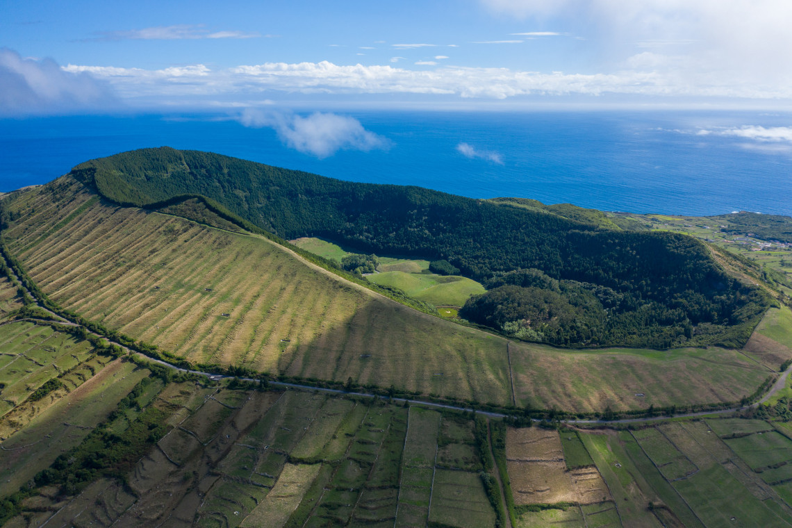
The rim walk around the Caldeira da Graciosa is the island's most rewarding hike. The trail runs along the top of the volcanic crater at approximately 405 meters altitude, alternating between views into the crater's interior and panoramic views across the whole island to the ocean. On clear days, Terceira, São Jorge, and Pico are visible from the rim.
The inside walls of the Caldeira are covered in native laurisilva forest. The crater floor, which holds no lake, drops steeply below the path. The volcanic geology along the rim is well-exposed, and the combination of altitude, open sky, and geological scale makes this one of the most atmospherically interesting walks in the central Azores.
The trail is accessible from the road that ascends from Santa Cruz toward the Caldeira. The surface varies between compacted earth and some rocky sections; standard walking shoes are adequate in dry conditions, though trail shoes are better after rain. The circuit can be extended or shortened depending on your starting point.
2. Furna da Maria Encantada Trail
Distance: 2 to 4 km (depending on approach) | Time: 1 to 2 hours | Difficulty: Easy
The trail to Furna da Maria Encantada is typically combined with the Caldeira visit and forms the most natural half-day circuit on the island. The cave itself has a naturally formed opening that frames the Caldeira behind it; the afternoon light inside the cave's mouth makes this one of the more photogenic spots on Graciosa.
The approach from the Caldeira road is straightforward and well-marked. The path descends gently from the crater rim to the cave entrance, which is large enough to walk into comfortably. From the cave, the views back toward the Caldeira are the reward for the descent.
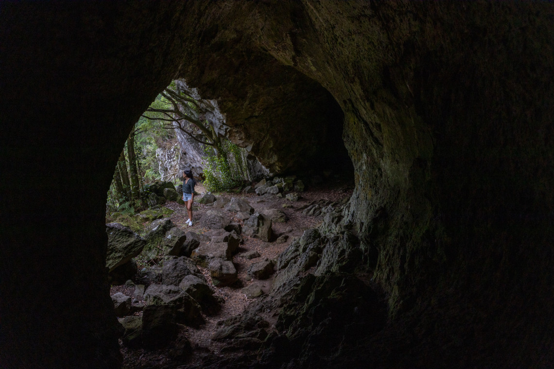
This trail is accessible to virtually all fitness levels. The main consideration is footing on the descent in wet conditions, when the path can become slippery. Walking shoes with grip are sufficient.
GUIDED HIKING ON GRACIOSA
Guided hikes on Graciosa include the Caldeira circuit and the Serra Branca trail, with geological and ecological context from local guides. A guided visit is particularly useful for understanding the volcanic history of the Caldeira and Furna do Enxofre within the same landscape.
Browse Hiking Tours →3. Serra Branca Trail
Distance: 4 to 7 km (one way or circuit options) | Time: 2 to 3.5 hours | Difficulty: Easy to Moderate
The Serra Branca trail is Graciosa's best walking route outside the Caldeira zone. It runs through the island's volcanic uplands, past ancient rock formations and native vegetation, with a mix of open heath and enclosed green corridors. The trail is accessible to walkers of all experience levels, with no significant technical sections and a gradual profile that avoids the steep descents found on some other Azores trails.
The route passes through terrain that reveals the island's geological character: the pale limestone soils that give Graciosa its "White Island" nickname are visible in the exposed hillside sections, and the contrast with the darker basalt of the Caldeira zone is noticeable. Views from the higher sections extend across a wide arc of the island.
Circuit and point-to-point options both exist; the most common approach is a loop starting and finishing near the central plateau. Download an offline map before starting, as signage on the upper sections is less consistent.
4. Ponta da Barca Coastal Walk
Distance: 2 to 5 km (depending on how far you walk from the parking area) | Time: 1 to 2.5 hours | Difficulty: Easy
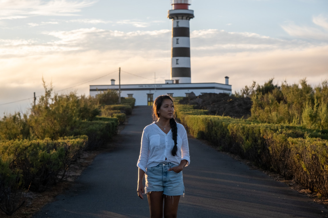
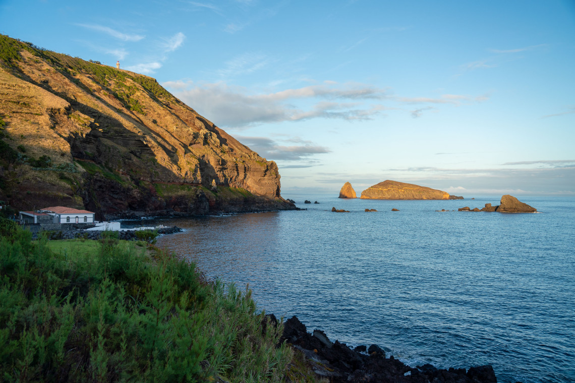
The road to the northwest tip of Graciosa ends near the Ponta da Barca lighthouse. From the parking area, a coastal path continues along the clifftop in both directions, with open Atlantic views to the north and west. The lighthouse itself, built in 1930 on a 71-meter basalt promontory, is accessible and worth exploring.
This is the most accessible dramatic coastal scenery on Graciosa for visitors who are not doing the Caldeira hike. The walking is mostly flat, the surface is compact earth and rock, and the effort-to-reward ratio is exceptional. The Baleia Islets are visible offshore; late afternoon provides the best light for the volcanic rock formations.
The path has no shade, so a hat and sunscreen are advisable in summer. The clifftop section requires some care near the edge, particularly in wind.
5. Carapacho to Ponta da Restinga (South Coast Walk)
Distance: 4 to 6 km (one way) | Time: 1.5 to 2.5 hours | Difficulty: Easy
The south coast walk between Carapacho and the Ponta da Restinga viewpoint is the quietest of the island's trails. The terrain is gentle, running along the coastal plateau with views south toward São Jorge and Pico across the channel. The route passes through small agricultural areas and volcanic rock formations close to the shoreline.
This walk suits visitors who want a low-effort morning or afternoon away from the main sights. The Termas do Carapacho at the start of the route makes a good beginning or end point; an afternoon soak after the walk is a reasonable plan. Point-to-point arrangements require a car at each end or a taxi pickup.
What to Bring
For Graciosa's trails, the basic kit is simpler than on the more demanding Azores islands. Walking shoes with grip are sufficient for all five routes in dry conditions; trail shoes are better for the Caldeira and Serra Branca after rain. Carry water on any route longer than 2 hours, as there are no water sources on the trails. A waterproof layer is useful even in summer, when Atlantic cloud can arrive quickly at altitude.
Mobile signal is inconsistent on the Caldeira rim and along the Serra Branca route. Download offline maps before leaving Santa Cruz.
When to Hike on Graciosa
April through October is the best window. May, June, and September offer reliable conditions with moderate temperatures and fewer visitors than July and August. The trails are walkable year-round, but winter brings more rain and the Caldeira rim can be in cloud for days at a time. Summer conditions are good but midday heat on the exposed south coast walk and the Ponta da Barca path warrants an early start.
Graciosa Island Vacation Packages
Flights, accommodation, and rental car arranged together. Graciosa pairs naturally with São Miguel, or as part of the central islands circuit with São Miguel and Terceira.
Keep reading
Frequently Asked Questions
Is Graciosa good for hiking?
Yes, particularly for visitors who want accessible trails without technical terrain. Graciosa's flat landscape makes it easier than the steep islands of the western or central group. The Caldeira rim walk is the most rewarding hike and provides geological context that few other Azores trails match. The island is best for a half-day or full day of walking rather than a multi-day trekking itinerary.
What is the best hike on Graciosa Island?
The Caldeira rim trail is the standout. It runs at 405 meters altitude around the volcanic crater, with views across the whole island and, on clear days, to three neighboring islands. The Furna da Maria Encantada extension adds a cave visit within the same half-day circuit. Together they form the most complete walking experience on the island.
Do you need a guide to hike on Graciosa?
No for most routes. The Caldeira trail, Furna da Maria Encantada, and the Ponta da Barca walk are all manageable independently. A guide adds geological and ecological context that is genuinely useful on the Caldeira circuit, where the volcanic history of the site is complex and not explained by trailside signage. For the Serra Branca trail, a guide or downloaded offline map is advisable as upper-section signage is inconsistent.
What footwear do you need for hiking on Graciosa?
Walking shoes with grip are adequate for all trails in dry conditions. Trail shoes are better for the Caldeira and Serra Branca routes after rain, when exposed sections can be slippery. Sandals or flat-soled shoes are not suitable for the Caldeira rim or the rocky sections of the Ponta da Barca clifftop path.
Can you hike on Graciosa in winter?
All five trails are walkable year-round. Winter brings more rain and the Caldeira rim is frequently in cloud from November through February, limiting views. The south coast walk and the Ponta da Barca path are drier and more reliable in winter than the high-altitude routes. If you are visiting specifically for the Caldeira panorama, April through October gives the most reliable conditions.
How long does the Caldeira hike take?
The rim circuit takes 1.5 to 2.5 hours depending on pace and how often you stop. Adding the descent to Furna da Maria Encantada and return extends the total to 2.5 to 4 hours. Most visitors combine the hike with a visit to Furna do Enxofre in the morning, making a full Caldeira half-day that covers the island's main geological highlights.