02 September 2026 • 7 min read
São Jorge is the most hiking-oriented island in the central Azores group. Its long, narrow shape concentrates trails along two contrasting coastlines: the north coast, where dramatic cliffs drop to isolated fajãs accessible only on foot, and the south coast, where gentler terrain reaches coffee plantations and volcanic geology. The central ridge adds high-altitude routes with views that extend to four neighboring islands on clear days.
Season: April to October | Footwear: Trail shoes or boots required | Base: Velas (south coast)
1. North Coast Trail: Fajã dos Cubres to Fajã da Caldeira de Santo Cristo
Distance: 5 km return | Time: 3 to 4 hours | Difficulty: Moderate
The most celebrated hike on São Jorge and, for many visitors, the reason they came to the island. The trail starts at Fajã dos Cubres on the north coast (reachable by road via a steep descent from the central plateau) and runs west along the base of the cliffs to Fajã da Caldeira de Santo Cristo, the only fajã on the island with no road access.
The path is mostly flat but the surface varies between gravel, volcanic rock, and grass. Some sections are narrow, with a significant drop to the ocean on one side. The destination is one of the most remote and visually striking places in the Azores: a flat lava plateau with a clam lagoon, a surf break, a small café, and a handful of permanent residents.
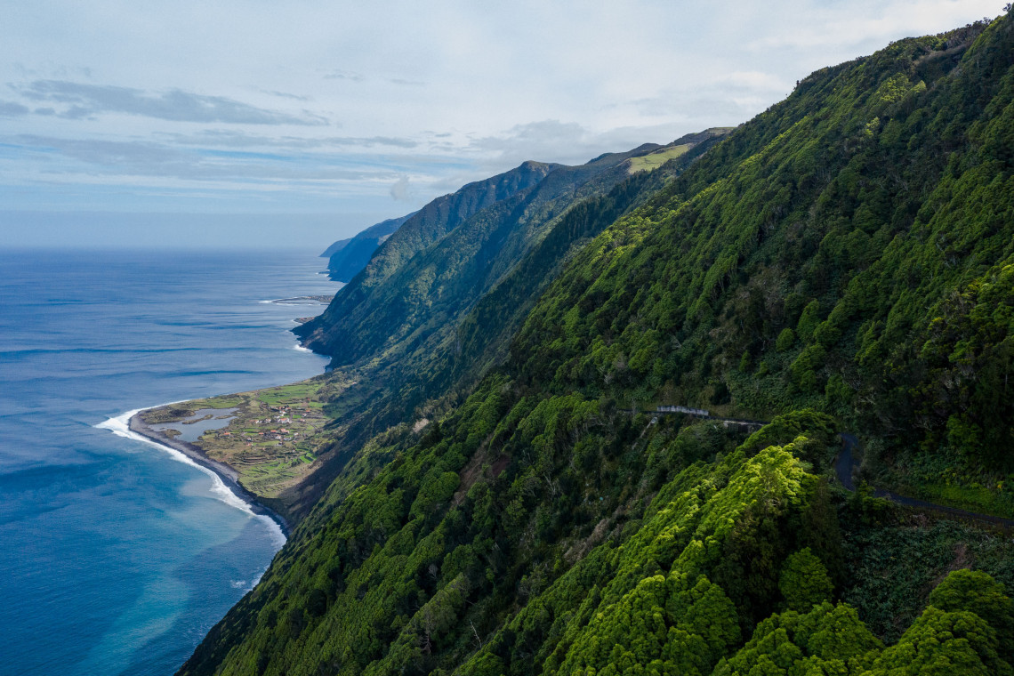
Allow 1 to 1.5 hours each way. Return on the same trail. Start as early as possible in summer; 7:30 to 8:30 am is ideal. Carry at least 1.5 liters of water per person.
GUIDED HIKING TOURS
Guided hikes to Fajã da Caldeira de Santo Cristo include ecological context on the clam lagoon and some operators offer a motorbike transfer back, saving the return leg on foot.
Browse Hiking Tours →2. Pico da Esperança (Central Ridge)
Distance: Variable (7 to 12 km depending on start point) | Time: 4 to 6 hours | Difficulty: Moderate to Challenging
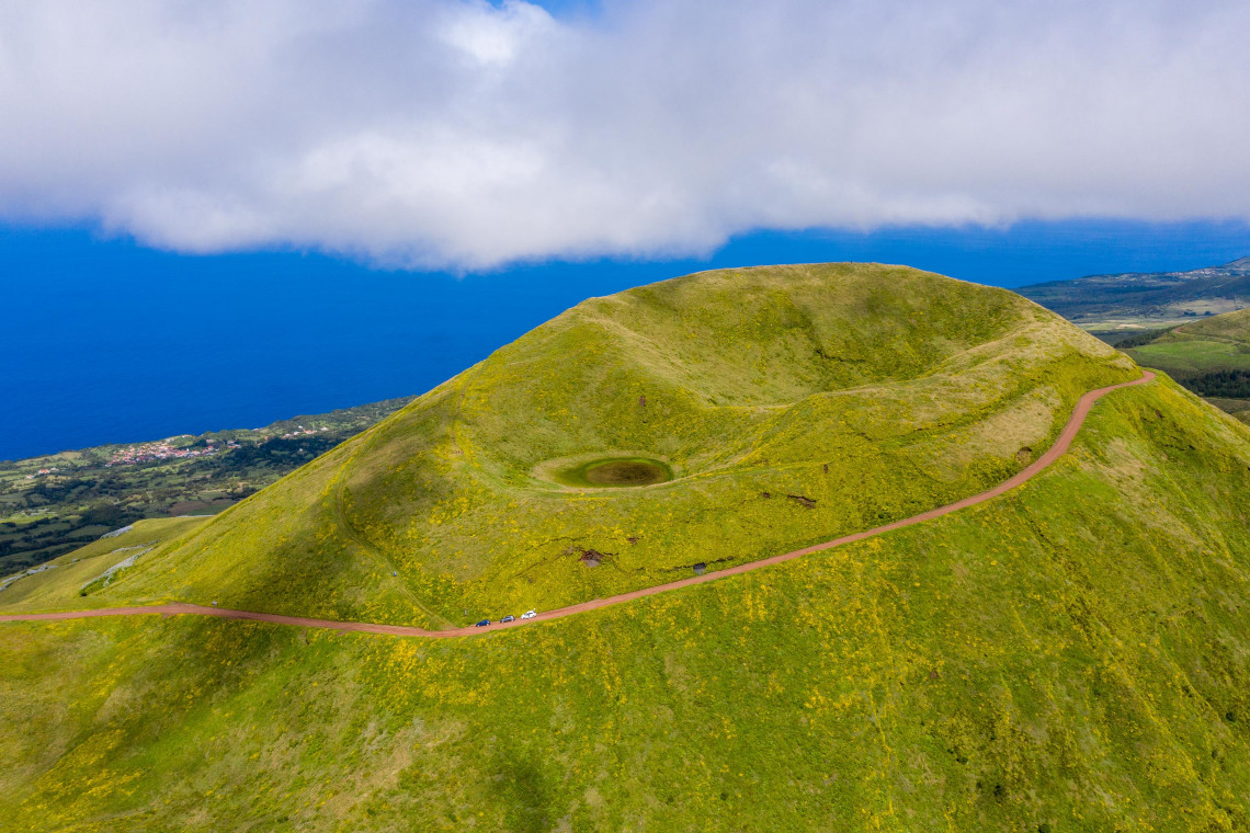
Pico da Esperança is the highest point on São Jorge at 1,053 m. The summit trail follows the central volcanic ridge of the island, passing through cloud forest, open heathland, and volcanic rock formations. On clear days, the panorama extends to Faial, Pico, Graciosa, and Terceira.
The most common approach is from the road near Serra do Topo on the central plateau. The terrain is steeper and more exposed than the north coast trail, and the weather at altitude can change quickly. Cloud cover and wind are common even when the coast below is clear. Layers and waterproofs are advisable year-round.
This route is best done with a guide on a first visit, since the upper ridge trail is less clearly marked than the lowland paths.
3. Ponta dos Rosais Coastal Walk
Distance: 3 to 5 km (depending on how far you walk from the parking area) | Time: 1.5 to 2.5 hours | Difficulty: Easy to Moderate
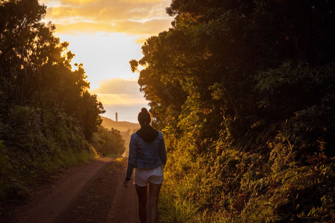
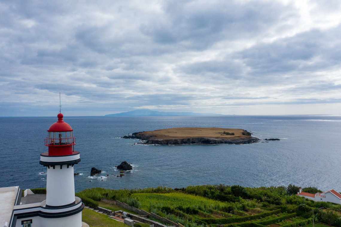
The western tip of São Jorge terminates at Ponta dos Rosais, where the abandoned lighthouse sits on top of volcanic cliffs with views north and west across open Atlantic. The road from Velas reaches a parking area near the lighthouse (about 25 minutes driving), and from there a walking path continues along the clifftop. The abandoned lighthouse complex itself is accessible and worth exploring.
This is the most accessible dramatic coastal scenery on São Jorge for visitors who are not doing the north coast hike. The walking is straightforward and the views are disproportionate to the effort.
4. Fajã de São João and the North Coast Fajãs
Distance: Variable | Time: 2 to 4 hours depending on route | Difficulty: Moderate
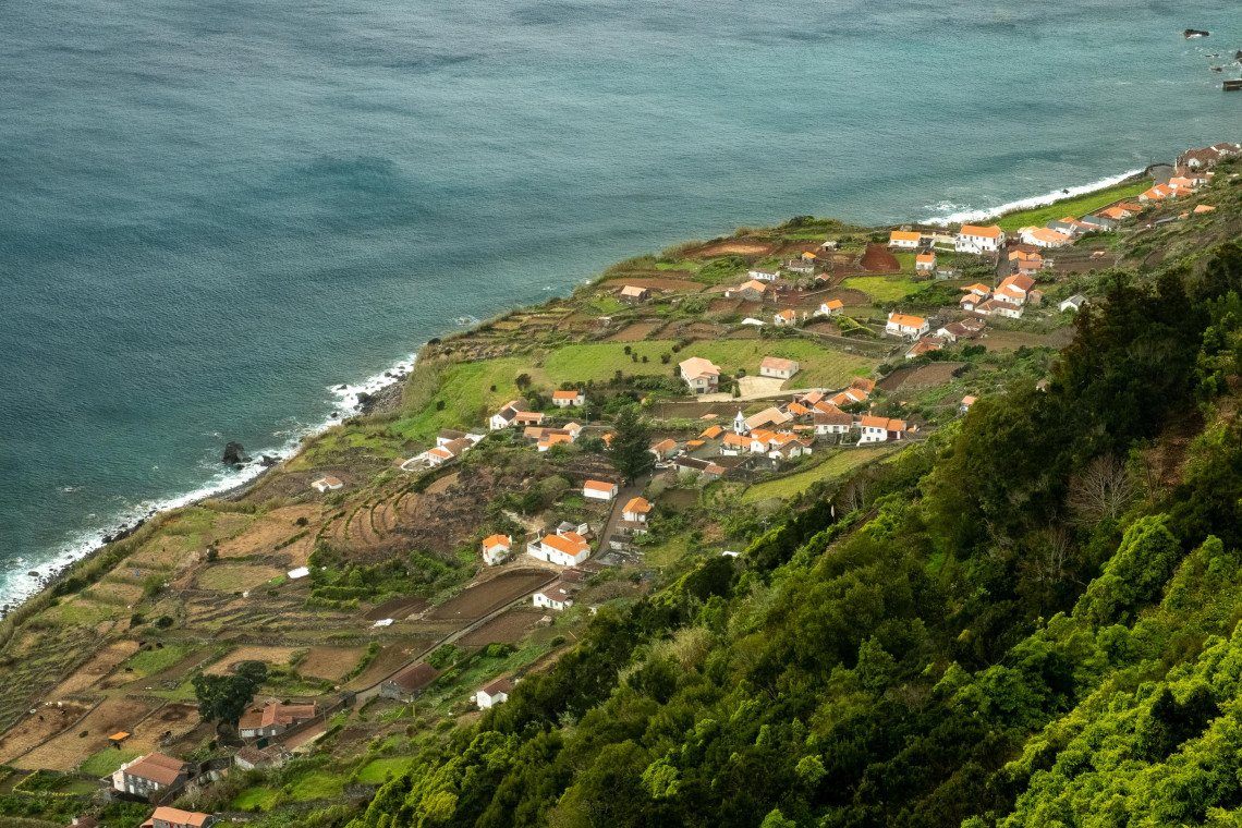
Several fajãs on the north coast are reachable by road, including Fajã de São João and Fajã da Ouvidor, both of which have small resident communities and walking access along the coastal shelf. These fajãs are quieter than Fajã dos Cubres and offer similar landscape character without the full hike to Santo Cristo.
Fajã da Ouvidor has a small restaurant (O Amílcar) where São Jorge clams are occasionally available. From here, shorter coastal walks connect to adjacent fajãs in both directions.
5. Topo to Urzelina (South Coast)
Distance: 8 to 10 km (one way) | Time: 3 to 4 hours | Difficulty: Easy to Moderate
The south coast of São Jorge between Topo and Urzelina offers a very different hiking environment from the north coast: gentler terrain, more vegetation, and views south toward Pico and Faial across the channel. The route passes through small villages and lava fields from the 1808 Urzelina eruption.
This walk works well as a point-to-point route with a car shuttle or taxi arranged at each end. It is less trafficked than the north coast routes and suited to visitors who want a quieter half-day walk without the steep terrain.
What to Bring
For all São Jorge hikes, regardless of difficulty: trail shoes or walking boots (sandals are not adequate on any of these routes), at least 1.5 liters of water per person, sunscreen and a hat for summer, and a waterproof layer for the central ridge. The island's weather changes quickly and altitude brings additional exposure.
Download offline maps before you go. Mobile signal is absent on the north coast trail and inconsistent across the central ridge.
When to Hike on São Jorge
April through October is the best window. May and June offer the clearest trails and most reliable weather without peak season crowds. July and August are dry but busier; the north coast trail in particular sees more day hikers. September and early October combine warm temperatures with quieter conditions and excellent visibility.
The north coast trail is not recommended after heavy rain. The rocky sections near Fajã dos Cubres become slippery and the coastal path narrows. The central ridge is accessible year-round but cloud cover makes navigation more challenging in winter, and the summit is often socked in from November through March.
SÃO JORGE TOURS
Full-day guided tours of São Jorge include the north coast fajãs, Ponta dos Rosais, and a stop for São Jorge cheese. A good option for first-time visitors who want to cover the island efficiently.
See All São Jorge Tours →São Jorge Island Vacation Packages
Flights, accommodation, and rental car arranged together. São Jorge pairs well with São Miguel or with the Triangle Islands circuit combining Faial and Pico.
Keep reading
Frequently Asked Questions
Is São Jorge a good island for hiking?
Yes, it is one of the best in the Azores. The north coast coastal trail to Fajã da Caldeira de Santo Cristo is the most distinctive hike in the archipelago. The central ridge at Pico da Esperança adds an alpine-character route with panoramic views. The south coast offers easier walking in more pastoral terrain. Together they give three very different hiking environments on one island.
Do I need a guide to hike on São Jorge?
Not for most routes. The north coast trail from Fajã dos Cubres is well-marked and straightforward to follow. The central ridge route to Pico da Esperança is more complex and a guide is recommended on a first visit due to less clear marking and rapidly changing weather. All hikes benefit from downloaded offline maps, as mobile signal is unreliable on the trails.
How difficult is the hike to Fajã da Caldeira de Santo Cristo?
Moderate. The trail is 2.5 km each way on varied terrain including volcanic rock sections. The elevation change is minimal, but the rocky surface requires appropriate footwear, and the return leg in summer heat can be tiring. Anyone with reasonable fitness and good shoes can complete it. Allow 3 to 4 hours total.
What is the highest point on São Jorge?
Pico da Esperança at 1,053 m, on the island's central volcanic ridge. Hiking to the summit from the road near Serra do Topo takes 4 to 6 hours depending on conditions. The summit is often in cloud, so check the forecast before heading up.
Can I hike on São Jorge in winter?
The south coast routes and lower trails are walkable year-round. The north coast trail is not recommended after heavy rain. The central ridge is accessible in winter but often in cloud, which limits visibility and navigation. Spring (April, May) marks the return of reliable hiking conditions.
What footwear do I need for hiking on São Jorge?
Trail shoes or walking boots are required for all routes. The north coast trail in particular has rocky, uneven sections where sandals or trainers without ankle support are inadequate. Running shoes are acceptable in dry conditions but trail-specific footwear is more reliable.