September 2026 • 12 min read
The Azores archipelago sits above one of the most volcanically active spots in the Atlantic, and the landscape shows it in every direction. Crater lakes, calderas, lava tubes, geothermal valleys, and basalt sea stacks define the nine islands — no two of which look alike. The Azores was the first archipelago in the world to be certified as a sustainable destination by EarthCheck, and that designation reflects how seriously the islands take conservation of what they have.
This guide covers 25 natural landscapes across all nine islands — organized by island, with practical notes on each. The list starts where most visits do: São Miguel.
São Miguel Island
São Miguel is the largest island and the one most visitors reach first. It packs more landscape variety into a single island than most countries manage across their entire territory.
1. Sete Cidades
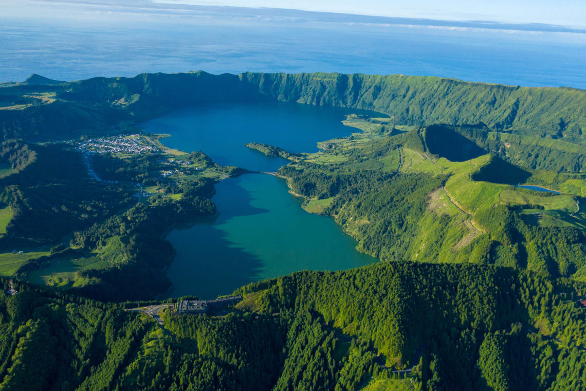
The twin crater lakes of Sete Cidades — Lagoa Azul and Lagoa Verde — sit inside a volcanic caldera 12 km across on the western end of São Miguel. The blue and green colours of the two lakes, visible from the rim viewpoints, are the most photographed image in the Azores. Vista do Rei (544 m) gives the classic angle directly down into the caldera. Boca do Inferno gives a wider panorama including the smaller crater lakes. Both viewpoints require an early start: cloud reaches the rim by mid-morning on most summer days. Sete Cidades is one of the Seven Natural Wonders of Portugal.
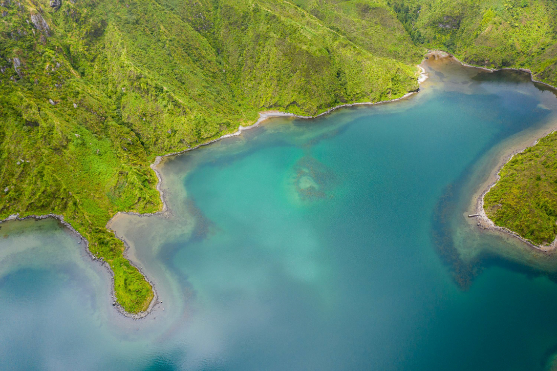
2. Lagoa do Fogo
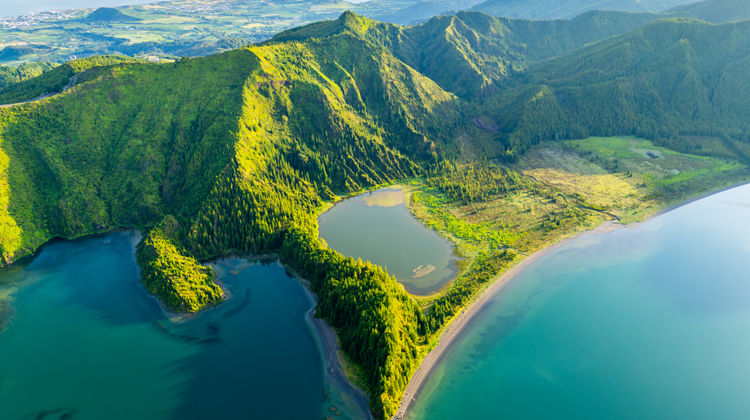
A volcanic crater lake at the centre of the island, at 776 metres above sea level — the highest lake in the Azores. Lagoa do Fogo (Lake of Fire) sits inside a nature reserve and is surrounded by laurisilva forest and volcanic heath. The lake is accessible by a hiking trail from the viewpoint road — roughly 4 km return, with a small sandy beach at the bottom where swimming is permitted. From June to September, private vehicles cannot reach the viewpoint between 9 a.m. and 7 p.m.; a shuttle operates from Caldeira Velha and Casa da Água.
3. Furnas Valley
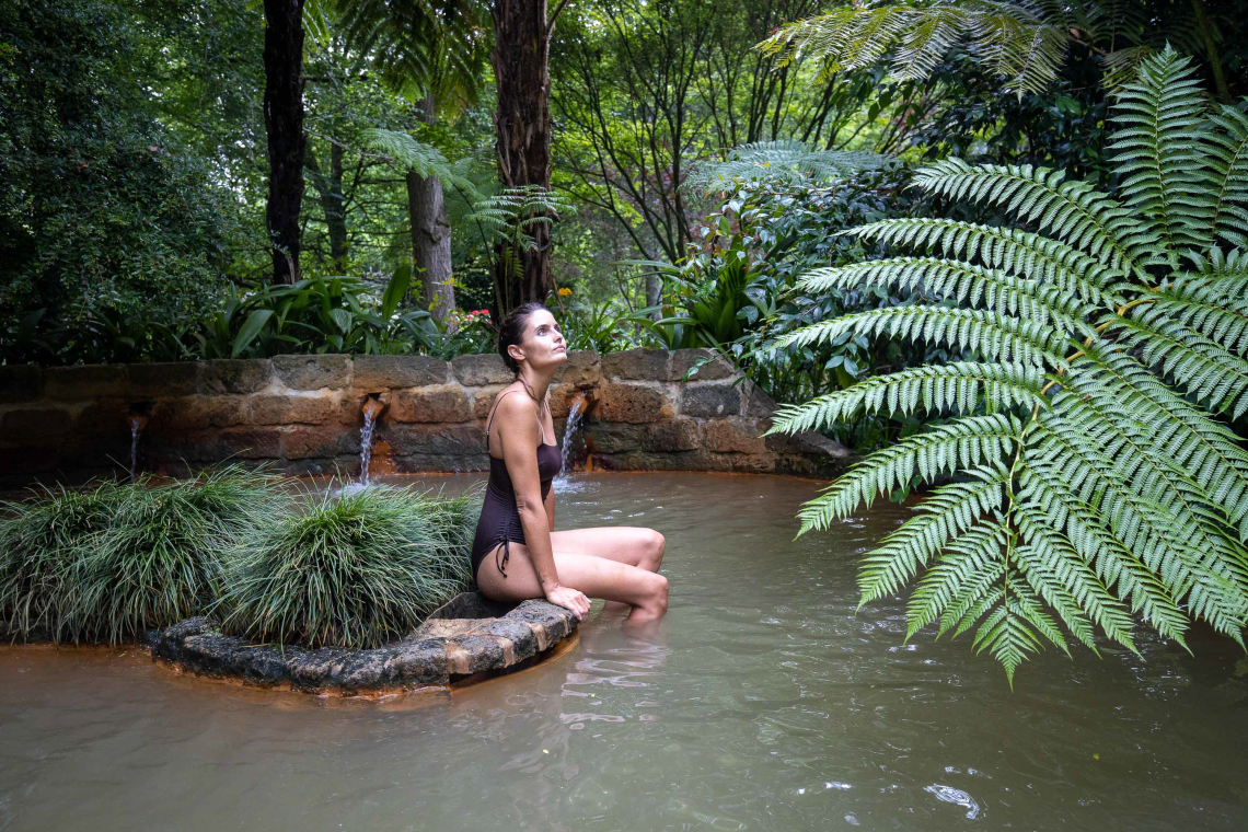
Furnas is a volcanic valley in the eastern part of São Miguel where geothermal activity reaches the surface in the form of bubbling fumaroles, hot springs, and caldeiras. The most visited site is the Caldeira das Furnas, where the ground boils visibly and local restaurants lower pots of cozido (a slow-cooked stew) into the earth to cook for several hours using volcanic heat. Terra Nostra Park in the village has a large thermal pool surrounded by botanical gardens. Furnas is one of the few places in the world where you can directly interact with a live volcanic system at ground level.
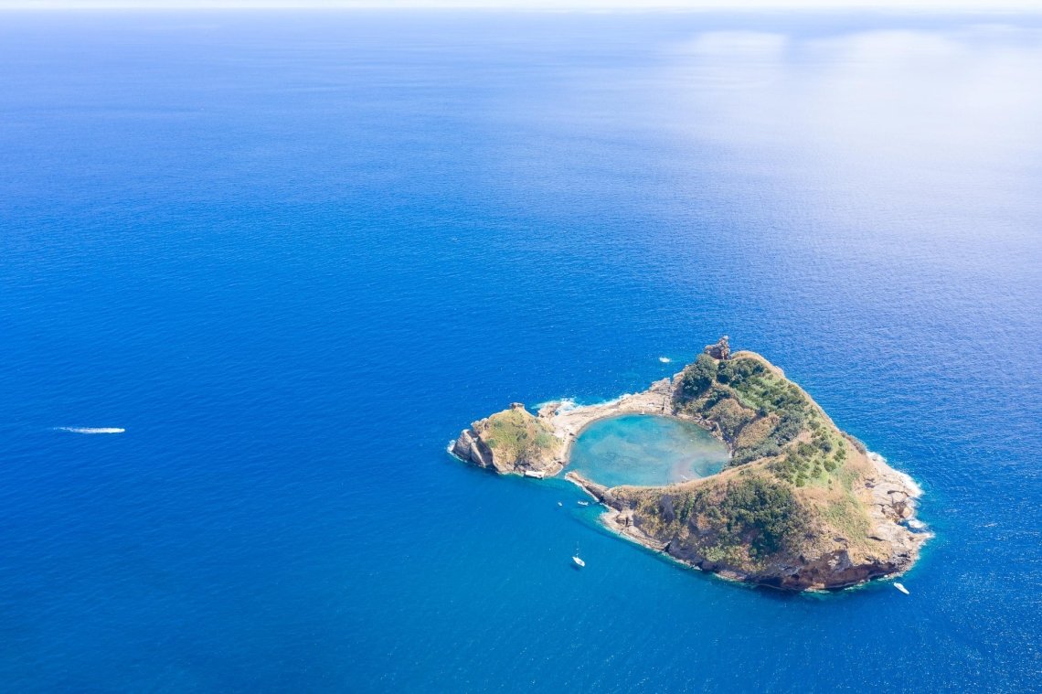
4. Vila Franca do Campo Islet
A small circular islet approximately 1 km off the south coast of São Miguel, formed by the collapsed crater of a submarine volcano. The rim of the crater creates a natural sheltered pool ideal for swimming and snorkelling. Access is by boat from Vila Franca do Campo, with a daily visitor limit that is strictly enforced — book in advance. The combination of clear Atlantic water and the geometric shape of the flooded crater is unlike any other swimming site in the Azores.
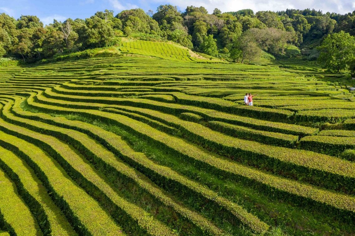
5. Gorreana and Porto Formoso Tea Plantations
The only commercial tea plantations in Europe, established on the north coast of São Miguel in the 19th century. Gorreana is the older of the two operations and has been producing tea continuously since 1883. The plantations sit on the hillside above the north coast, with the ocean visible from the rows of tea bushes. Both are open to visitors, the production process is visible, and tea tasting is free. The Gorreana estate covers around 37 hectares and the walk through the plantation takes 20 to 30 minutes.
Santa Maria Island
The southernmost island in the archipelago, Santa Maria is the oldest geologically and the only one with sedimentary rock and sandy beaches. It has a noticeably different character from the other islands: drier, sunnier, and with a landscape more reminiscent of the Algarve than of the volcanic north.
6. São Lourenço Bay
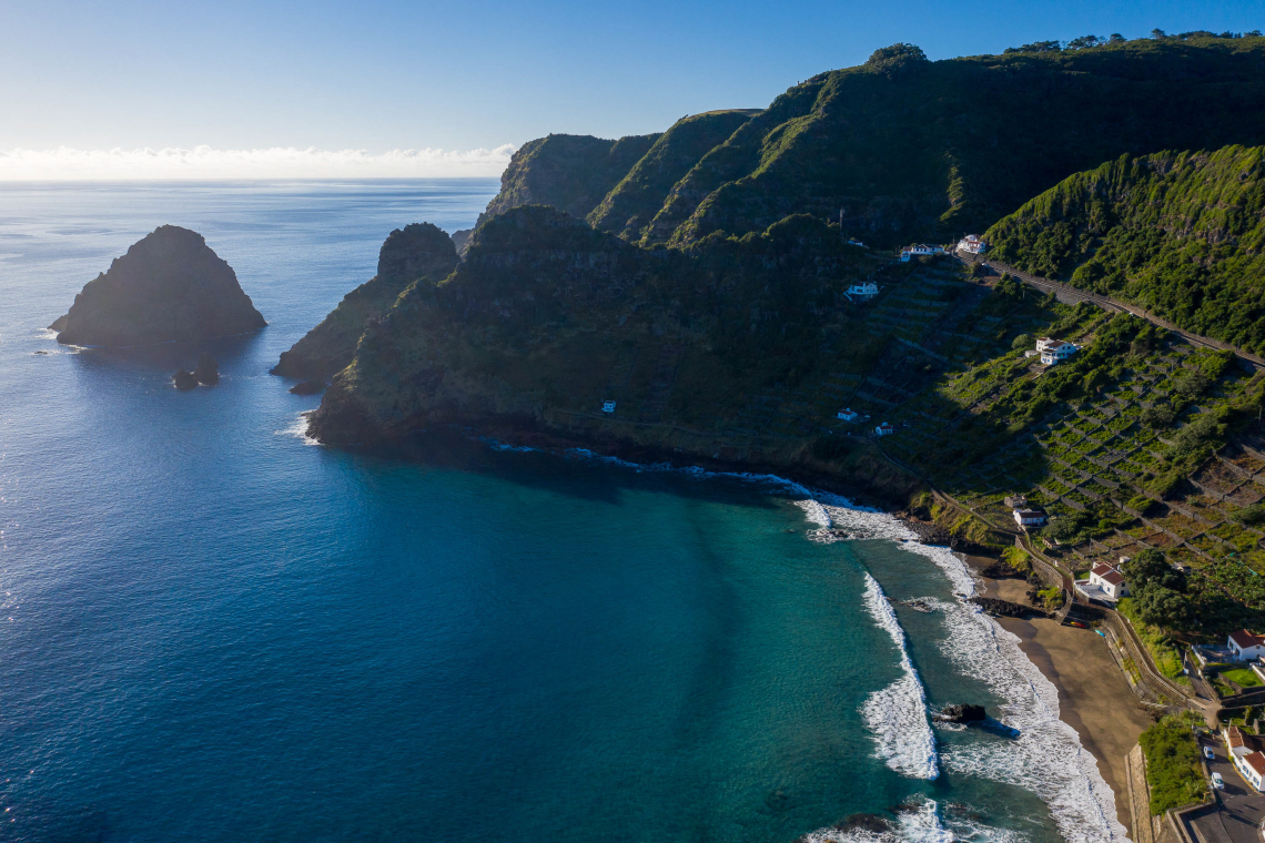
A wide bay on the south coast of Santa Maria with turquoise water, golden sand, and a series of small offshore islets. São Lourenço is the most photographed beach landscape in Santa Maria and one of the most distinctive beach settings in the entire archipelago. The bay is sheltered and the water clarity is exceptional — significantly better than the north coast Atlantic-facing beaches elsewhere in the Azores.
7. Barreiro da Faneca
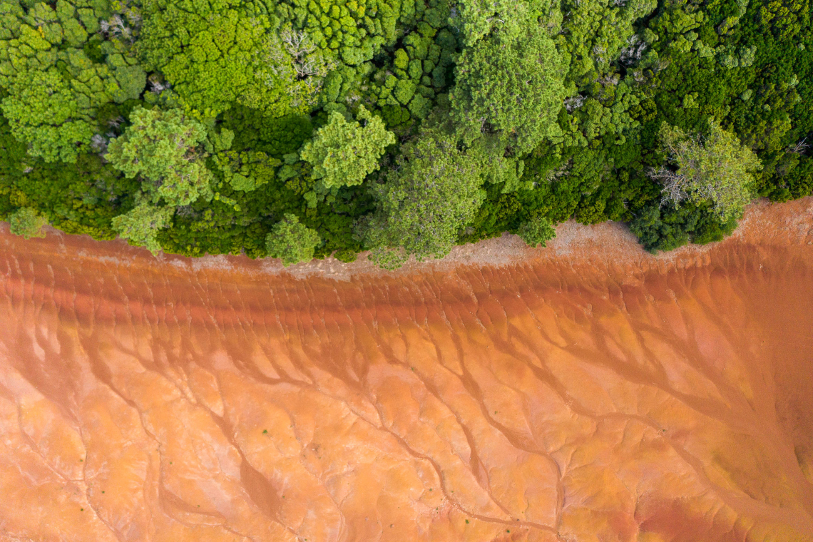
A protected landscape of red clay soil in the northwest of Santa Maria, known informally as the "Red Desert of the Azores". The rust-coloured terrain is the result of volcanic ash deposits with a high iron content, creating an ochre landscape completely unlike anything else in the archipelago. The contrast with the surrounding green fields makes it visually striking and immediately recognisable from aerial photographs.
Pico Island
Pico is defined by its volcano — the highest peak in Portugal at 2,351 metres — and by the dramatic basalt lava fields that cover its coastline, including the UNESCO-listed vineyard landscape of the western shore.
8. Mount Pico
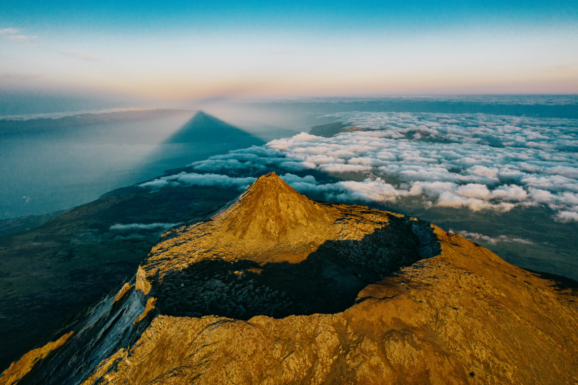
The volcano dominates every view on the island and from the sea approaches. Mount Pico (Montanha do Pico) can be climbed by anyone with reasonable fitness and appropriate footwear — the ascent takes 3 to 4 hours and the descent 2 to 3 hours, with a mandatory local guide required above 1,950 metres. Guides are arranged through the Pico Mountain House (Casa da Montanha) in Madalena. The summit view on a clear day encompasses the entire central group of islands. The climb is weather-dependent and frequently cancelled due to cloud, so flexibility is essential.
9. Criação Velha Vineyards (UNESCO)
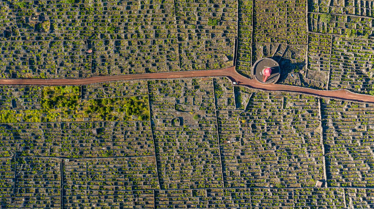
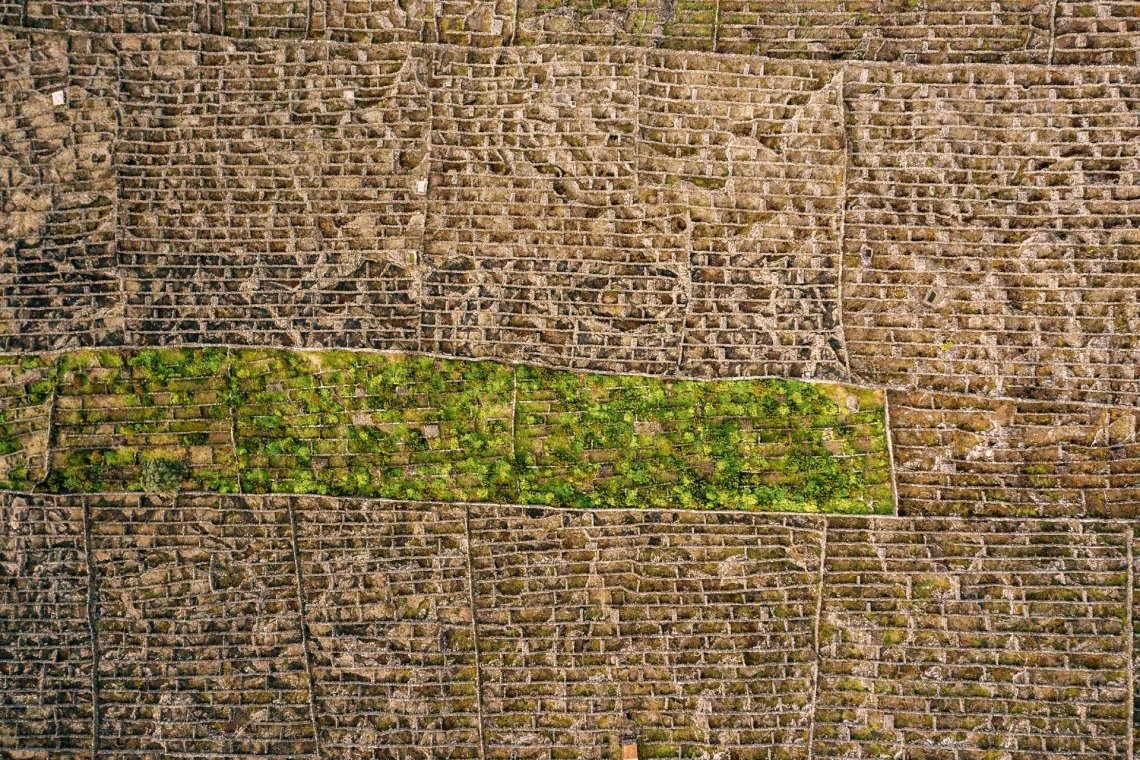
The vineyard landscape of western Pico Island — one of two UNESCO World Heritage Sites in the Azores. Early settlers cleared and arranged the coastal basalt lava into low-walled enclosures called currais, each protecting a small number of vines from Atlantic wind and spray. The resulting landscape of black rock, no visible soil, ocean horizon, and the volcano behind is completely unlike any other wine-growing region in Europe. The Verdelho grape has been cultivated here since the 15th century. The area around Criação Velha and Madalena has the most intact sections of the landscape.
São Jorge Island
São Jorge is a narrow, steep island rising sharply from the Atlantic, with dramatic cliff coastlines and the unique fajã landforms that define its character.
10. Fajãs of São Jorge
A fajã is a flat platform of land at the base of a cliff, formed by ancient landslides or lava flows that reached the sea and solidified. São Jorge has dozens of them, scattered along both the north and south coasts. Each fajã is effectively its own microworld: accessible only on foot or by boat, with small communities, fishermen's houses, and in some cases lagoons used for surfing and swimming. Fajã dos Cubres (north coast) and Fajã da Caldeira de Santo Cristo (north coast) are the most visited, the latter with a lagoon and the only natural cockle (lagoa) of the archipelago.
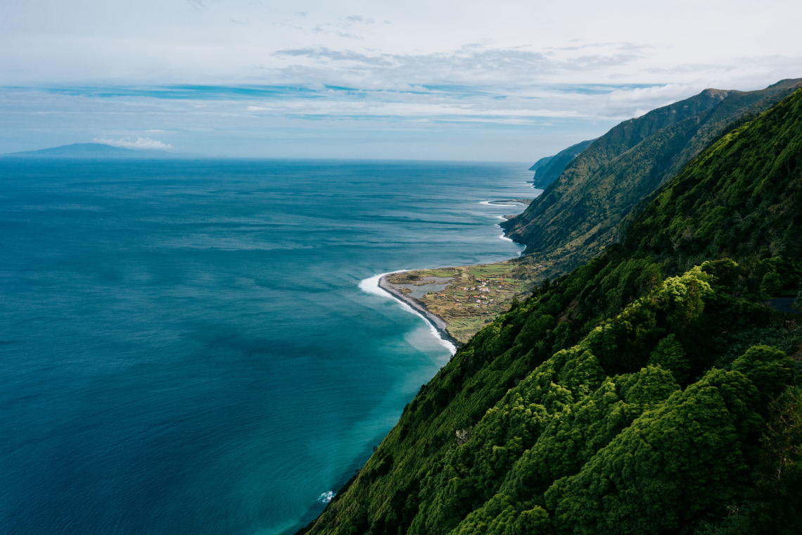
11. São Jorge Islets and Coastline
The north coast of São Jorge features a series of offshore islets and sea stacks visible from the clifftop roads and viewpoints. The most dramatic section is around Urzelina and the western end of the island, where basalt columns and stacks rise from the Atlantic. The coastline here is entirely inaccessible from below, which means the views are best from the ridge road above.
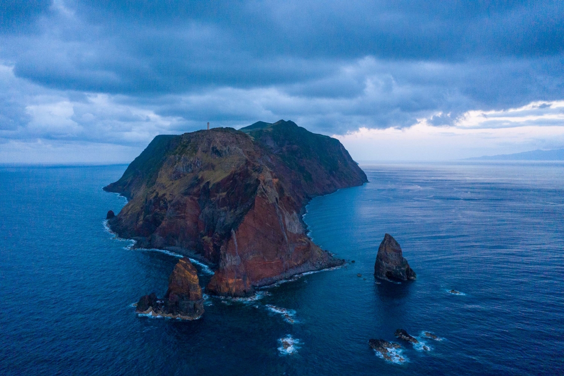
Terceira Island
Terceira has a layered landscape: a green patchwork of dairy farms and hydrangea hedgerows visible from the central viewpoints, a UNESCO historic city at sea level, and a series of volcanic features accessible by walking trails.
12. Serra do Cume
The most famous viewpoint on Terceira, at around 550 metres in the eastern caldera. From the Serra do Cume, the patchwork of pasture fields divided by hydrangea hedgerows spreads across the caldera floor below, with the Atlantic visible on all sides. The geometry of the field divisions, seen from above, is one of the most distinctive aerial views in the Azores. The road to the viewpoint is accessible by car.
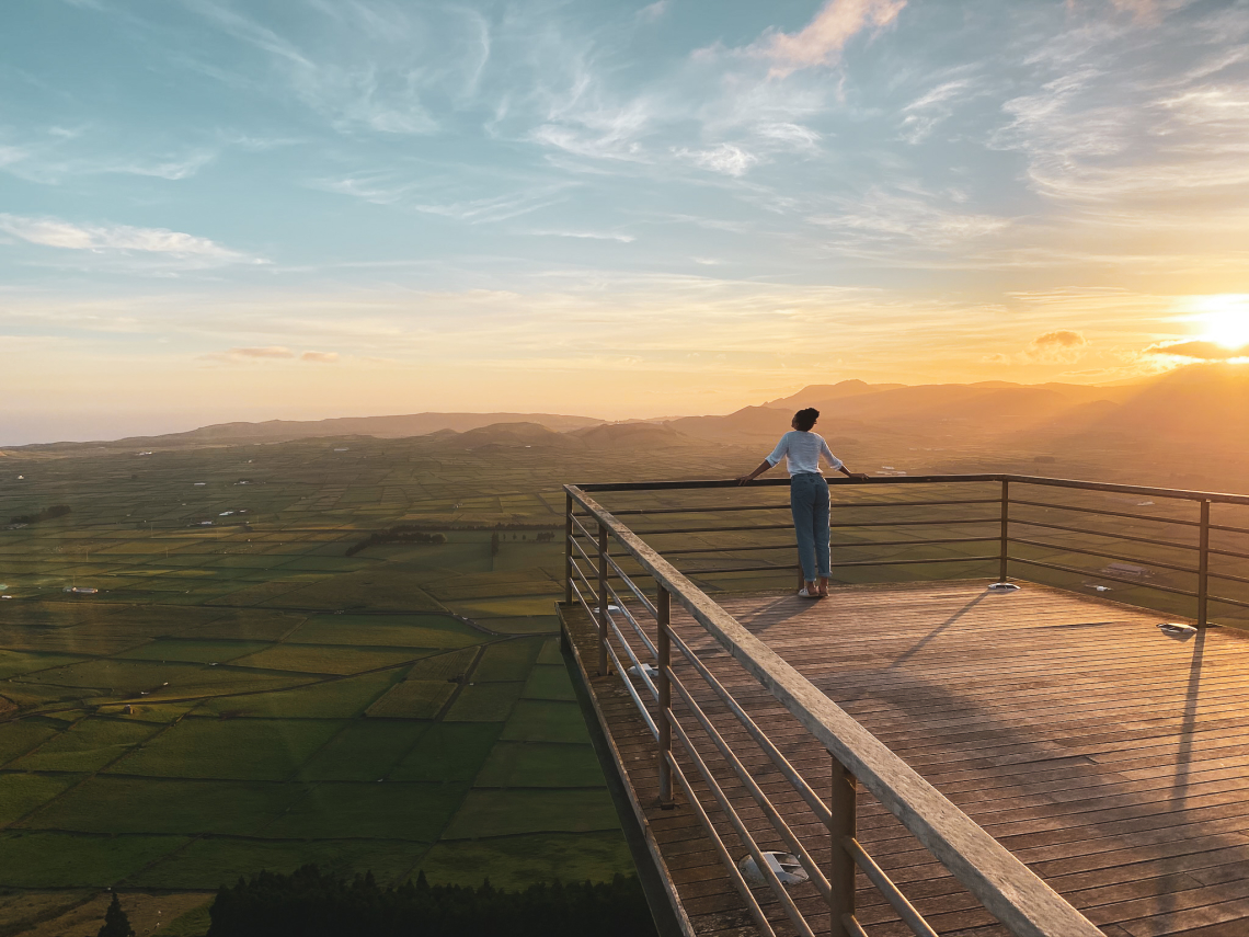
13. Algar do Carvão
A lava tube and volcanic chimney near the centre of Terceira that is open to visitors — one of the very few volcanoes in the world you can enter. A staircase descends 90 metres into the chamber, where a freshwater lake collects at the bottom. The walls of the tube are coated in stalactites of silica and iron oxide. Opening hours are seasonal and access is managed — check the current schedule before visiting. The combination of going underground into an active volcanic structure makes this one of the most unusual geological experiences in Europe.
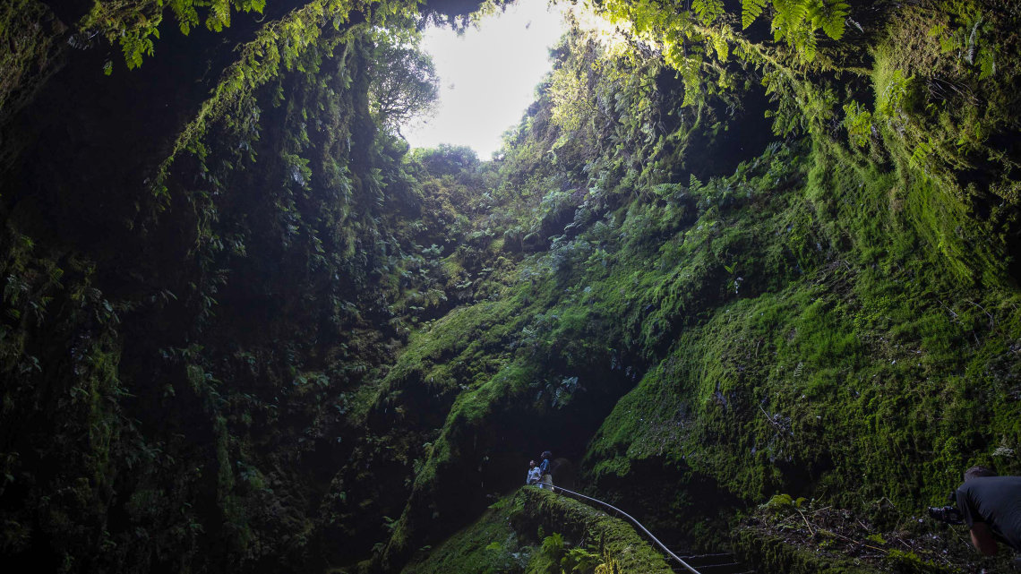
14. Monte Brasil
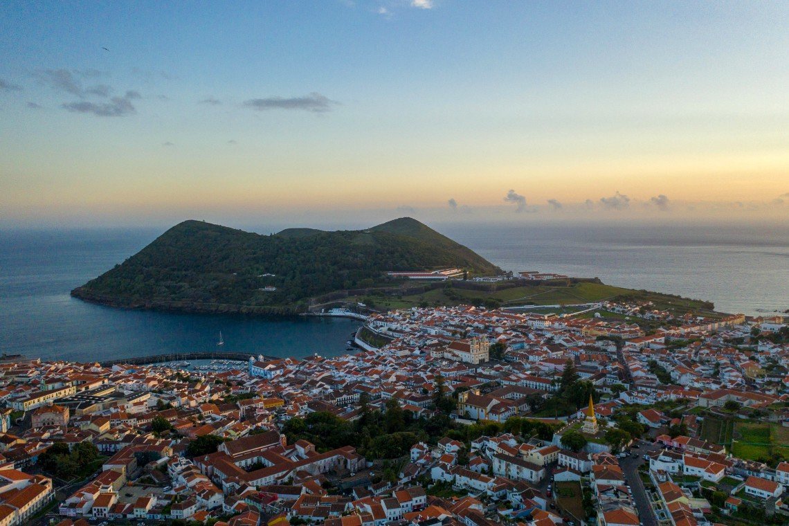
A volcanic peninsula attached to Angra do Heroísmo on the south coast of Terceira, rising to 205 metres and visible from the city. Monte Brasil is a collapsed volcanic cone whose eruption created the natural harbour around which Angra was built. Walking trails cross the forested slopes to the fort at the summit, from which the city, the bay, and the surrounding coastline are all visible. The combination of geology, fortification history, and the view over a UNESCO-listed city makes it worth the 45-minute walk from Angra.
AZORES VACATION PACKAGES
Multi-island packages combining São Miguel, Terceira, Faial and more — built by local experts with flights, hotel, and rental car included. The car is essential for reaching most of the landscapes on this list.
See Azores Packages →Faial Island
Faial is the hub of the central group, known for its marina at Horta (a key transatlantic sailing waypoint), its dramatic caldeira, and the Capelinhos volcanic landscape on the western cape.
15. Capelinhos Volcano
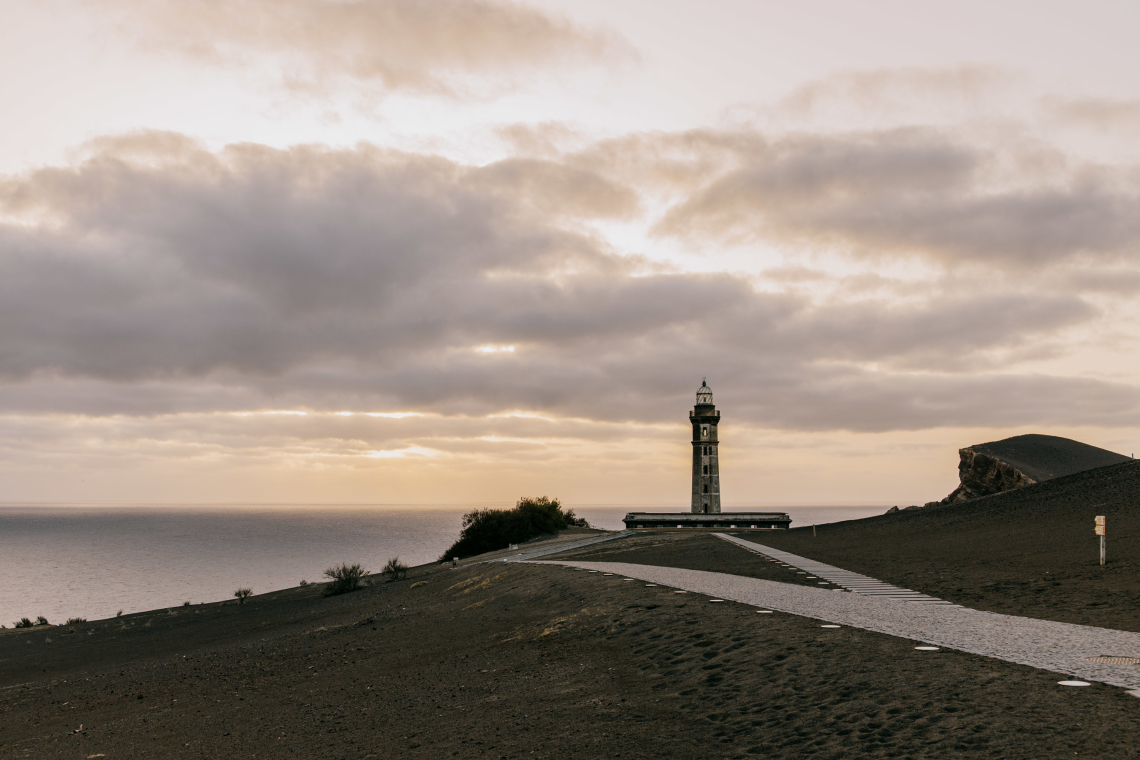
The site of the Azores' most recent volcanic eruption, which began in September 1957 and lasted until October 1958. The eruption added approximately 2.4 km² to the western tip of Faial and buried the original lighthouse under volcanic ash. The lighthouse now emerges partway from the debris. An interpretation centre built into the base of the old lighthouse explains the eruption and its effect on the local population (many families emigrated to the United States as a result). The landscape of black ash, lava fields, and the half-buried lighthouse is like nothing else in the Azores — a reminder that these islands are geologically new and still active.
16. Porto Pim Bay
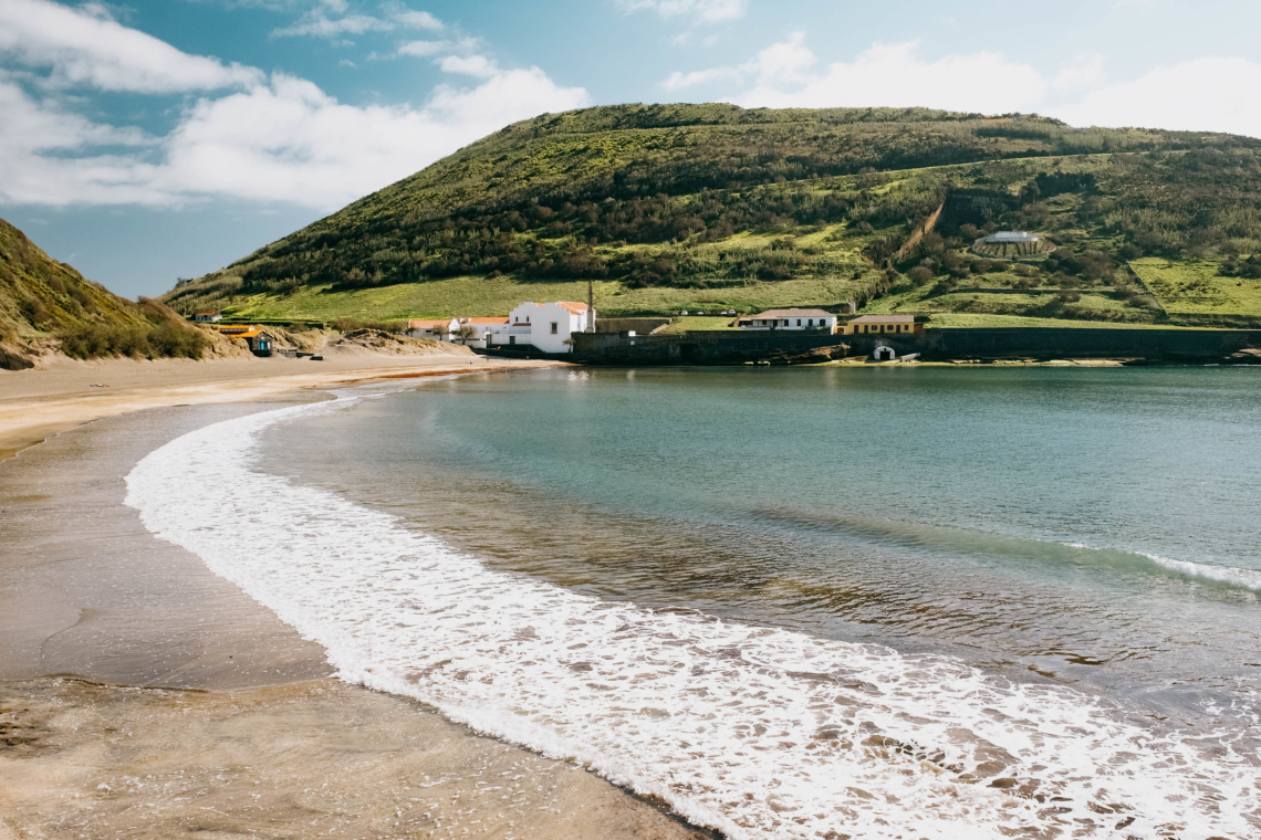
A sheltered bay on the south coast of Faial, adjacent to Horta, with one of the best beaches in the central group. Porto Pim was historically the site of a whaling station — the old factory building is still visible on the headland. The bay is calm and protected from Atlantic swells, making it the most reliably swimmable beach on Faial.
17. Caldeira do Faial
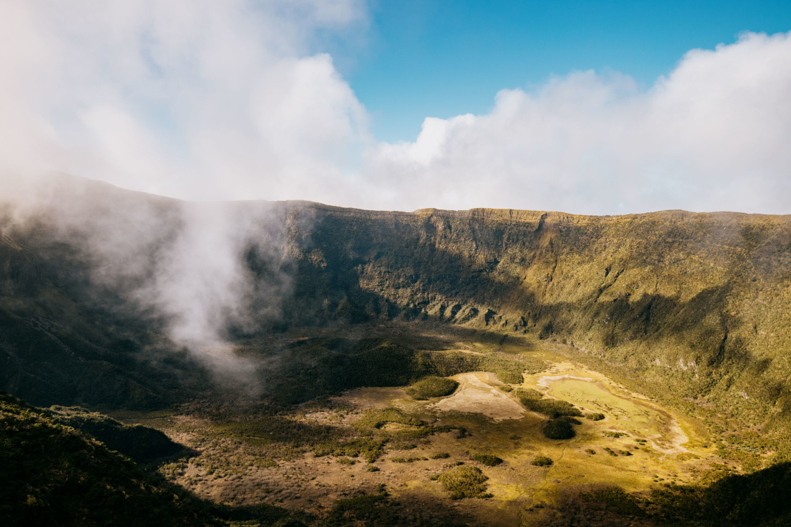
The volcanic caldeira of Faial — a 400-metre-deep crater, 1.5 km in diameter, at the centre of the island — is accessible via a circular rim trail. The interior of the caldeira is a nature reserve with rare endemic flora including tree heathers and mosses. The rim trail takes approximately 2 to 3 hours to complete and gives views into the crater and across the island. The altitude means weather on the rim is often different from the coast — bring a windproof layer.
Graciosa Island
The flattest and most agricultural of the islands, Graciosa's main natural attractions are the Flemish-influenced windmills distributed across the landscape and one of the most extraordinary geological features in the archipelago.
18. Windmills of Graciosa
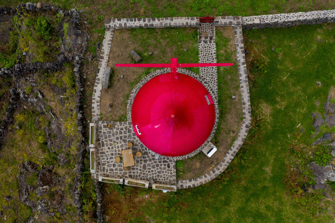
Traditional windmills with conical red-capped roofs dot the Graciosa landscape — a legacy of Flemish settlers who brought the design to the island in the early settlement period. The windmills are a visible part of the island's working agricultural history and several have been restored. They appear at intervals along the roads and hillsides and are the most distinctively Graciosa element of the island's visual identity.
19. Furna do Enxofre
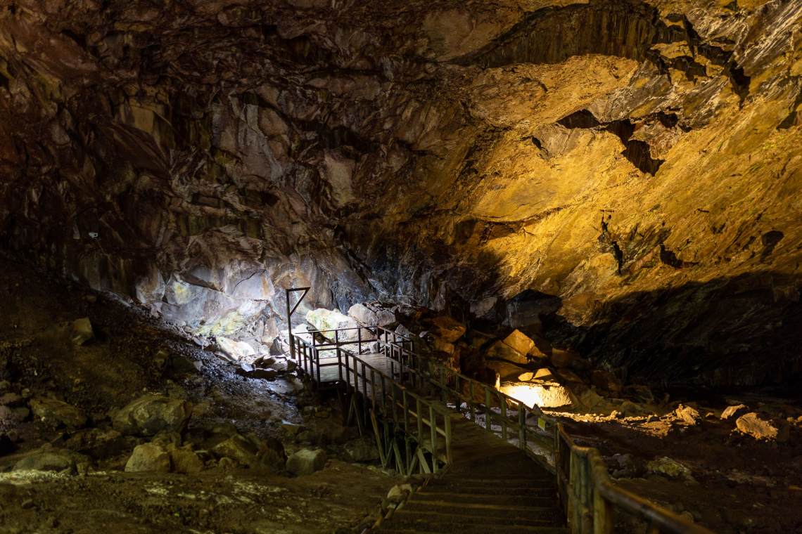
A volcanic cave on Graciosa containing a lake of sulphurous water at the bottom of a 40-metre-deep chamber. Natural skylights in the cave roof (created when the lava ceiling collapsed) provide light from above. The cave is accessible via a staircase with handrails, and the combination of the lake, the volcanic gas smell, and the overhead light through the openings makes it one of the most atmospheric geological sites in the Azores. Entry is managed — check current opening hours in advance.
Flores Island
The westernmost of the main islands, Flores is the wettest and most dramatically green. Its name means "flowers" — a reference to the hydrangeas that blanket the island from May through September. Flores has five major waterfalls, seven lakes, and a coastline of basalt sea stacks.
20. Poço das Alagoinhas (Ribeira do Ferreiro)
A series of tiered waterfalls dropping through a valley of dense vegetation into a natural pool. The Ribeira do Ferreiro waterfall is the most photographed in Flores and one of the most visited natural sites on the island. The access path is short and well-marked. The pool at the base is swimmable in summer.
21. Poço do Bacalhau
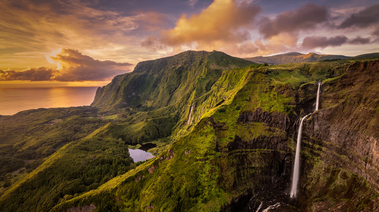
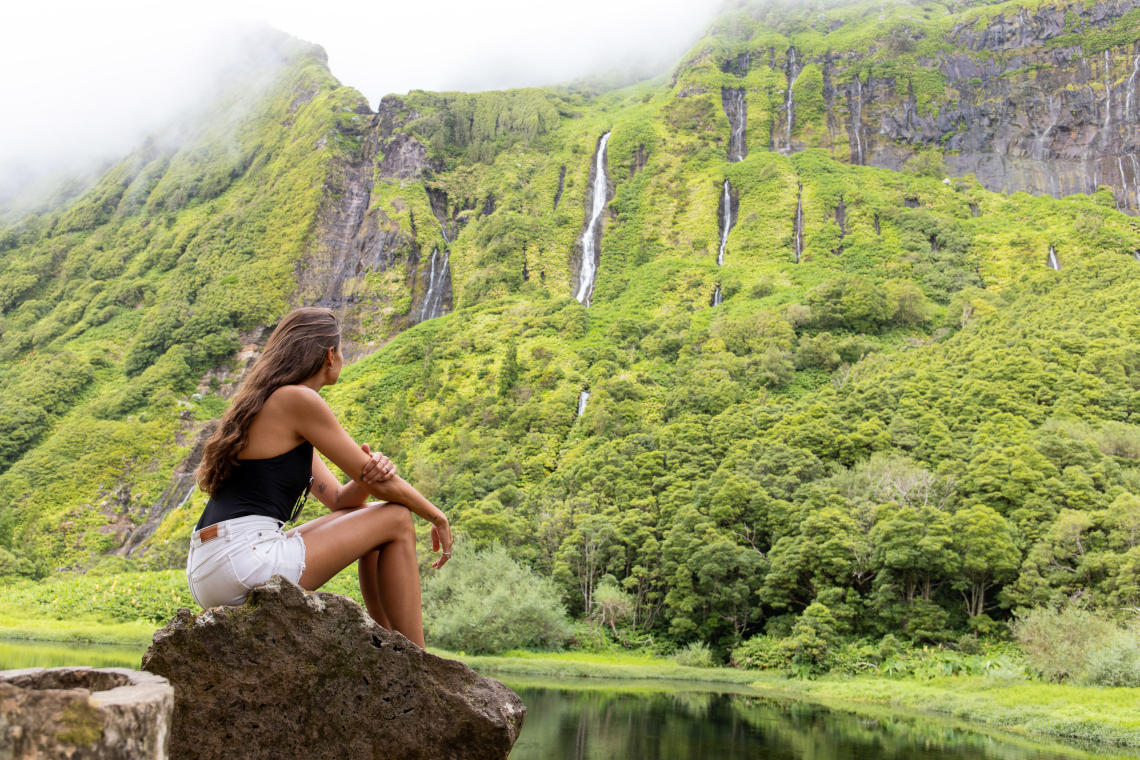
In Fajã Grande at the western end of Flores, a single powerful waterfall drops approximately 100 metres from the plateau rim to the valley floor below. The scale of the single drop — seen from across the valley — is more dramatic than the tiered waterfalls elsewhere on the island. A trail leads to the base of the waterfall.
22. The Seven Lakes of Flores
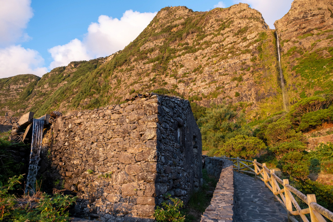
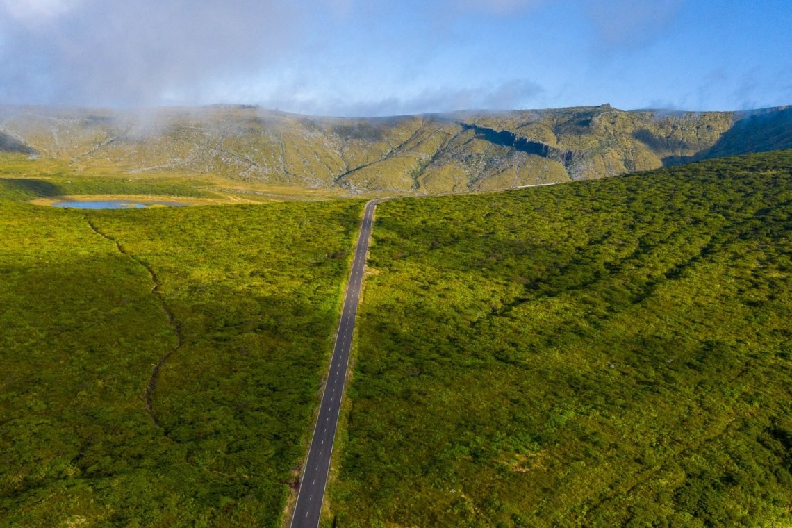
Flores has seven crater lakes distributed across the plateau interior: Lagoa Funda, Lagoa Rasa, Lagoa Seca, Lagoa Comprida, Lagoa do Lombo, Lagoa Branca, and Lagoa das Patas. The most visited are Lagoa Funda and Lagoa Rasa, often viewed together from the same miradouro. On clear mornings, the lakes sit below a layer of mist that burns off as the day warms — a landscape that photographically rewards arriving early.
23. Rocha dos Bordões
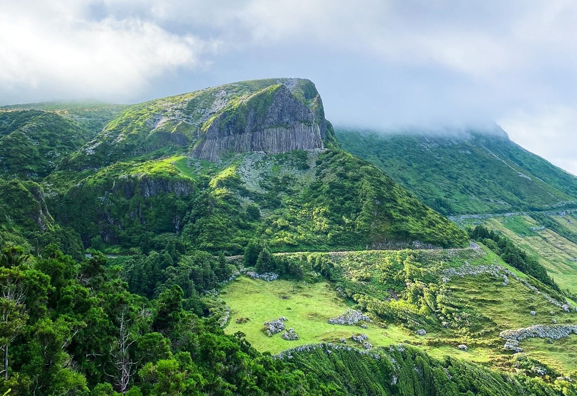
A series of vertical basalt columns on the northwest coast of Flores, formed by ancient lava cooling and contracting into hexagonal prisms. The columns reach several metres in height and the formation extends along the cliff face. Similar formations exist in Iceland (Svartifoss) and Ireland (Giant's Causeway) — the Azores version is less visited and less manicured, which makes it feel more genuinely remote.
24. Alagoa Bay
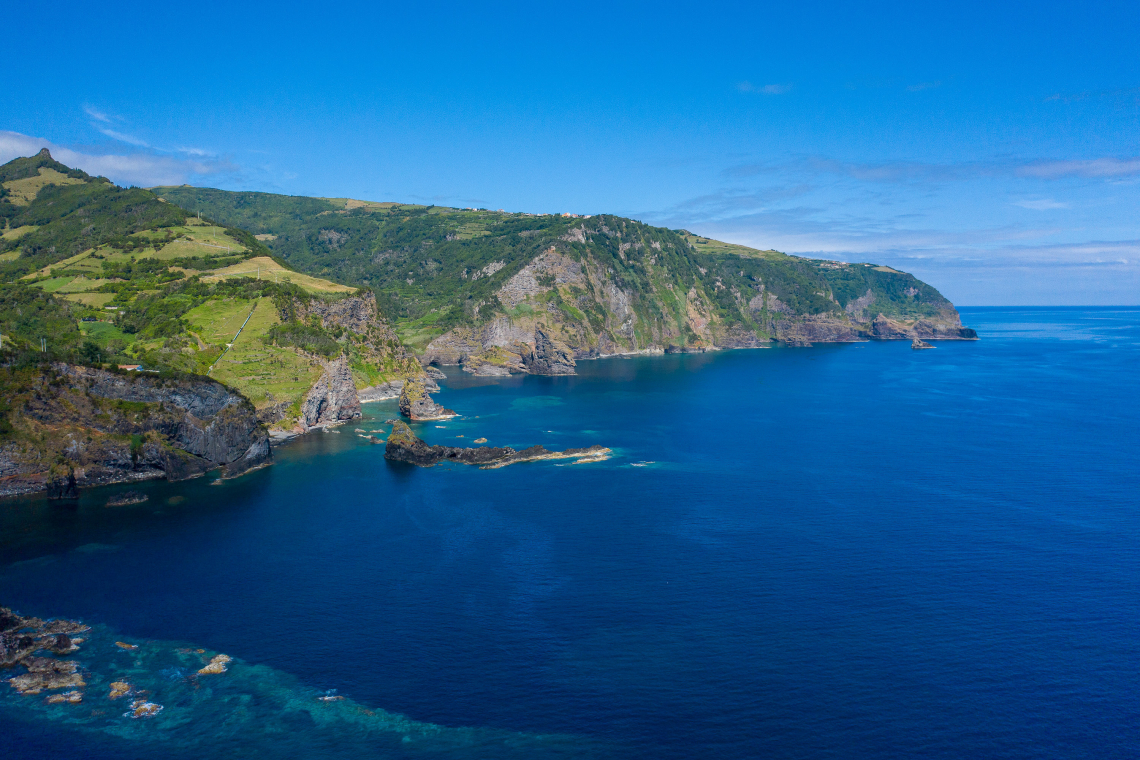
A coastal bay on the south of Flores with volcanic rock formations, sea stacks, and cliff faces descending to the water. The bay is accessible by a trail from the road above. The combination of Atlantic ocean clarity, basalt formations, and the dramatic cliff backdrop makes it one of the most visually complete coastal scenes on the island.
Corvo Island
The smallest island in the Azores at 17 km², Corvo's entire population numbers under 400 people. There is one village, one road to the top, and one reason most people make the effort to get there.
25. Caldeirão
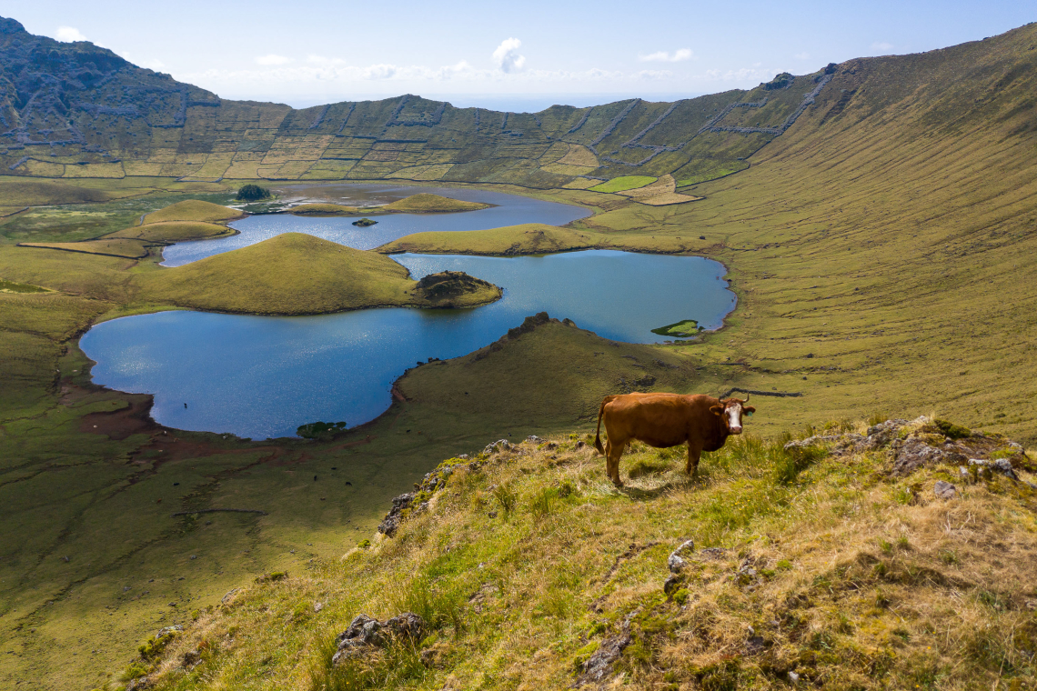
The volcanic caldera of Corvo is the defining feature of the island and one of the most dramatic calderas in the entire archipelago. The Caldeirão is approximately 300 metres deep and 3.7 km across, with two small lakes on the caldera floor and a scattering of farmland patches worked by the island's small population. The rim is accessible by road (a rough track) from the village of Corvo below. The scale of the caldera relative to the size of the island — visible nearly everywhere on Corvo — is what makes it so striking.
PLAN A CUSTOM AZORES TRIP
Not sure which islands to combine? Our Azorean advisors can build an itinerary around the landscapes and experiences that matter most to you — including the harder-to-reach western islands.
Build a Custom Trip →FAQ
What is the most famous natural landscape in the Azores?
Sete Cidades on São Miguel — the twin crater lakes of Lagoa Azul and Lagoa Verde seen from the caldera rim viewpoints — is the most photographed and most widely recognised natural landscape in the archipelago. It is one of the Seven Natural Wonders of Portugal and consistently appears in every visual representation of the islands.
Can you enter a volcano in the Azores?
Yes. Algar do Carvão on Terceira Island is a lava tube and volcanic chimney open to visitors, with a staircase descending 90 metres into the chamber. It is one of the only volcanoes in the world accessible to the public in this way. Access is seasonal — check opening hours before visiting.
What is a fajã?
A flat coastal platform formed at the base of a cliff, either by an ancient landslide or by lava flows that reached the sea and solidified. São Jorge Island has the highest concentration of fajãs in the Azores, each with its own micro-community, and some with freshwater lagoons used for swimming and surfing. Fajã da Caldeira de Santo Cristo is the most visited.
Is the Capelinhos volcano on Faial accessible?
Yes. The Capelinhos site on the western cape of Faial is open to visitors. An interpretation centre built into the base of the half-buried lighthouse covers the 1957–1958 eruption. The volcanic landscape — ash fields, lava flows, and the lighthouse emerging from the debris — is walkable from the interpretation centre.
What is the Barreiro da Faneca on Santa Maria?
A protected landscape in the northwest of Santa Maria where the soil is rust-red due to volcanic ash with high iron content. Known informally as the "Red Desert of the Azores", it is visually unlike anywhere else in the archipelago and a stark contrast to the surrounding green fields.
How do you reach Corvo Island?
By SATA Air Açores flight from Faial (the only direct connection to Corvo) or by inter-island ferry from Flores in summer. Corvo has no car rental — the island is small enough to walk, though some accommodation offers transfers. The Caldeirão caldera is the main reason to make the trip and takes a half day to visit properly.
Are there sandy beaches in the Azores?
The Azores is primarily a volcanic island group and most coastline is rocky rather than sandy. The main exceptions are Santa Maria Island (which has the only naturally sandy beaches in the Azores, including Praia Formosa and São Lourenço Bay) and a small number of black-sand beaches on São Miguel's north coast (Areal de Santa Bárbara). Most swimming in the Azores takes place at natural rock pools or sheltered bays rather than sandy beaches.
Keep Reading
São Miguel
Sete Cidades: Lakes, Viewpoints & Hiking
Hiking
Top 10 Hiking Trails in São Miguel Island
São Miguel
Hot Springs & Natural Pools in São Miguel
.jpg "Jeep tour through Cumeeiras, Sete Cidades, São Miguel Island")
.jpg "Sete Cidades Caldera Lakes in São Miguel Island, Azores")