October 2026 • 7 min read
The Azores hold seven UNESCO designations across three programmes. Two World Heritage Sites: the historic centre of Angra do Heroísmo on Terceira (1983) and the stone-walled vineyard landscape of Pico (2004). Four Biosphere Reserves: Corvo and Graciosa (2007), Flores (2009) and the Fajãs de São Jorge (2016). And one UNESCO Global Geopark covering all nine islands and the seabed around them, with 121 geosites.
You can see both World Heritage Sites in a single trip to Terceira and Pico, and every visitor to the Azores is inside the Geopark from the moment they land. This guide explains what each designation protects and how to visit it.
What UNESCO Recognises in the Azores, and Why It Matters
UNESCO runs several separate lists and the Azores appear on three of them. The World Heritage List recognises places of outstanding universal value, cultural or natural; the Azores have two, both cultural. The Man and the Biosphere programme designates reserves where people and nature are managed together; the Azores have four, all of them whole islands or most of one. The Global Geoparks network recognises landscapes of international geological significance; the entire archipelago is one.
For a traveller this is a useful shortlist. Between them the seven designations point to the Renaissance port of Angra, the lava-walled vineyards of Pico, the wildest islands of the western group, the fajãs of São Jorge and the volcanic landscapes of every island. Nobody sees all seven on one trip, but two or three fit naturally into a ten-day itinerary.
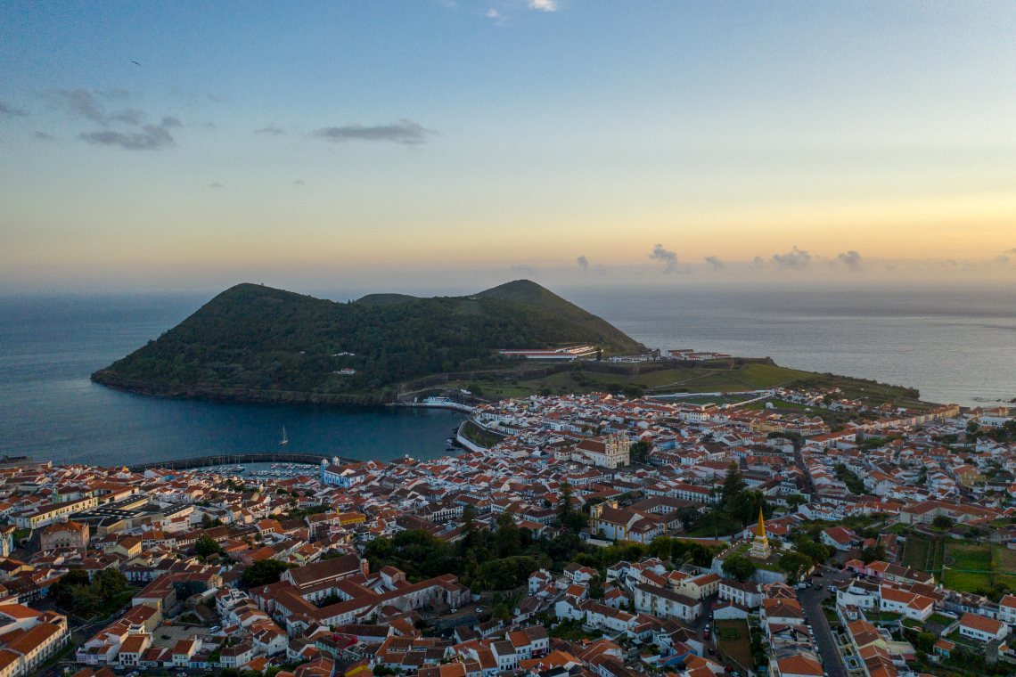
World Heritage: Central Zone of Angra do Heroísmo (Terceira, 1983)
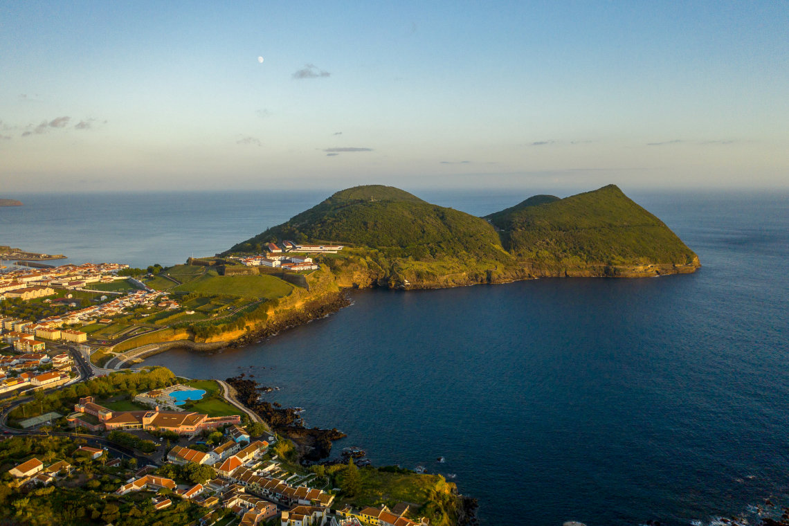
Angra was the first place in the Azores to be inscribed, under criteria (iv) and (vi): an outstanding example of a port town linked to the maritime exploration that connected Europe, Africa, the Americas and Asia from the 15th to the 19th century. Ships returning from the Indies and the Americas sheltered in its bay, and the town that grew up the hill behind the harbour kept its Renaissance grid, its Baroque cathedral, churches and convents, and two fortresses, São Sebastião and the enormous São João Baptista on Monte Brasil, built to protect the fleets.
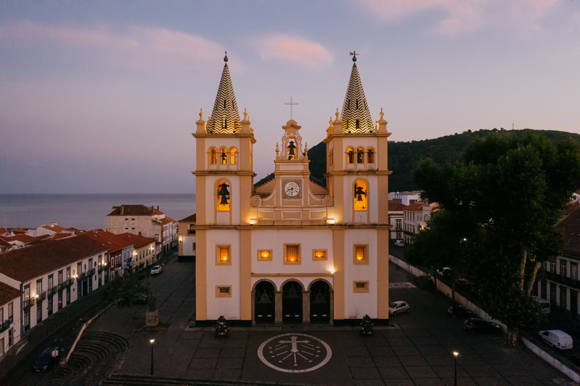
The inscription came three years after the earthquake of 1 January 1980, which killed more than 70 people on Terceira and damaged much of the historic centre. The decision to rebuild faithfully rather than modernise is part of why the town is on the list. Today Angra is a working city of pastel façades, a marina, a market and some of the best restaurants in the Azores, and it is easy to see on foot in half a day. Walk down Rua da Sé to the bay, climb Monte Brasil for the view over the whole site, and allow time for the Duke of Terceira Garden and the Alto da Memória obelisk.
Below the water, Angra Bay is an underwater archaeological park with the wreck of the steamship Lidador (1878) at about 7 metres and an anchor cemetery deeper down, which licensed dive centres visit. For a full visitor guide to the town, see our dedicated Angra do Heroísmo UNESCO article.
BOTH WORLD HERITAGE SITES IN ONE TRIP
Terceira, Pico and São Miguel with a rental car on each island: Angra do Heroísmo, the Pico vineyards and the lakes and hot springs of São Miguel in nine nights.
See the three-island package →World Heritage: Landscape of the Pico Island Vineyard Culture (Pico, 2004)
Pico's inscription, under criteria (iii) and (v), protects 987 hectares of coastal lava fields on the west and north of the island, with a buffer zone of a further 1,924 hectares. What UNESCO recognised is a human landscape: since the 15th century, islanders have grown vines on bare basalt by building thousands of small rectangular enclosures, the currais, from loose black lava stone, to shelter each plot from wind and salt spray. From above, the result looks like a vast net thrown over the coast. Around it sit the manor houses, wineries, distilleries, chapels and the rolas-pipas, the ramps cut into the rock where barrels were rolled down to boats.
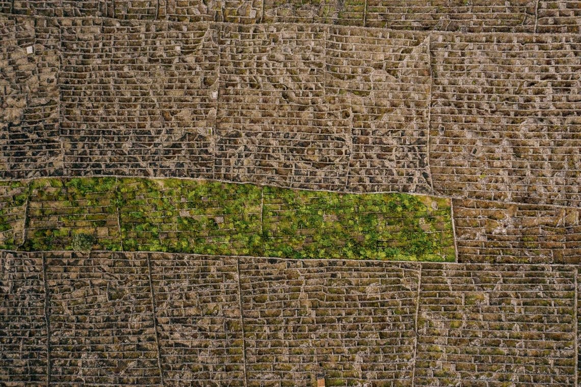
The two showcase areas are the Lajido da Criação Velha, just south of Madalena, and the Lajido de Santa Luzia on the north coast. A marked trail runs through Criação Velha past the red windmill at Frei Matias, and the Pico Wine Museum in Madalena, with its ancient dragon trees, explains the system. The wines themselves, dry whites from Verdelho, Arinto dos Açores and Terrantez do Pico, are tasted at the Madalena cooperative and small producers along the coast. Our Pico vineyard guide covers the trail, the museum and the tastings in detail.
Biosphere Reserves: Corvo, Graciosa, Flores and the Fajãs de São Jorge
UNESCO's Biosphere Reserves are not museums; they are inhabited landscapes where conservation and local life are meant to reinforce each other. Four Azorean islands qualify.
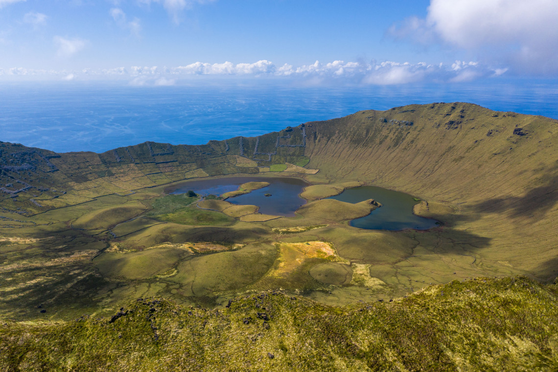
Corvo (2007) is the smallest and most northerly island, 17 km², with a single village and a single caldera, the Caldeirão, that fills most of the island. The reserve includes the surrounding sea. Corvo is reached by a short flight or the summer boat from Flores, and most visitors come for a day to walk the caldera rim and meet the 400 or so residents.
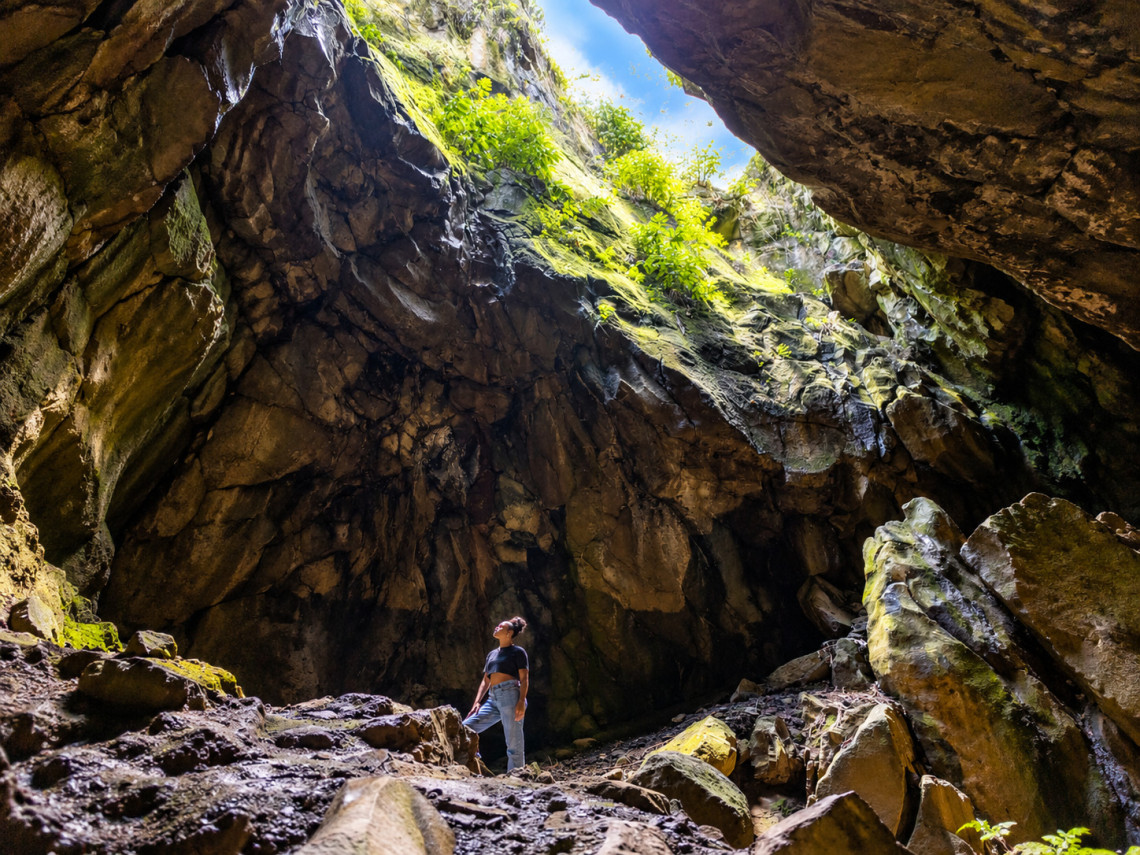
Graciosa (2007) is the gentlest of the islands, a landscape of low hills, windmills and vineyards with a caldera at its south-eastern end that hides the Furna do Enxofre, a lava cave with a sulphurous lake you descend into by a spiral tower. The reserve covers the whole island and its islets.
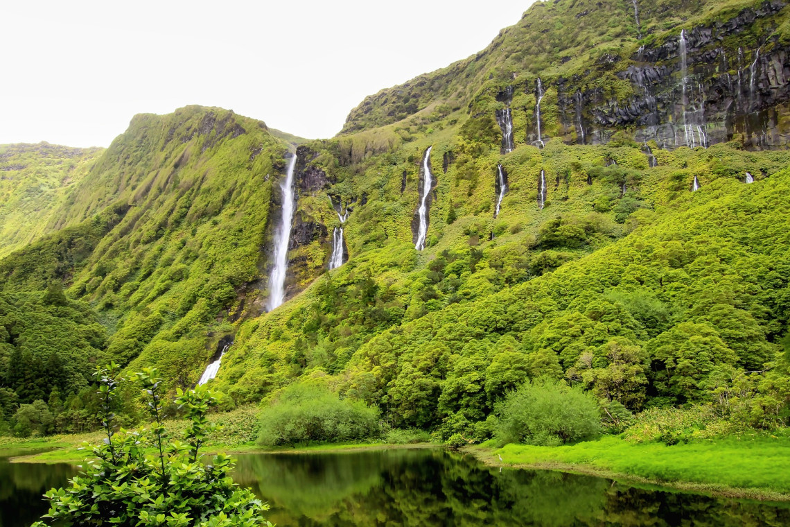
Flores (2009) is the westernmost point of Europe and the Azores' waterfall island: crater lakes on the plateau, cliffs streaked with cascades at Fajã Grande and the Poço da Ribeira do Ferreiro, and the Rocha dos Bordões basalt columns. The reserve takes in the island and its marine area.
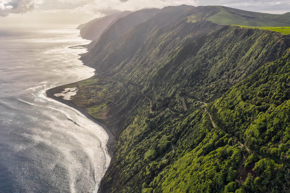
Fajãs de São Jorge (2016) protects the long, thin island of São Jorge and specifically its fajãs, the flat coastal strips at the foot of the cliffs formed by landslides and lava flows, where islanders built villages, grew coffee and yams and still make the island's famous cheese. The Fajã dos Cubres and Fajã da Caldeira de Santo Cristo, reachable only on foot, are the best known.
Itineraries built around the islands' history, villages and traditions, with flights, hotels and car included.
See cultural packages →The Azores UNESCO Global Geopark
The Geopark is the designation that covers everywhere you go. Created in 2010 and admitted to the European and Global Geoparks Networks in 2013, it became a UNESCO Global Geopark when UNESCO formalised that label in 2015. It extends over about 12,900 km², the nine islands and a large area of surrounding seabed, and it inventories 121 geosites, 57 of them priority sites for conservation.
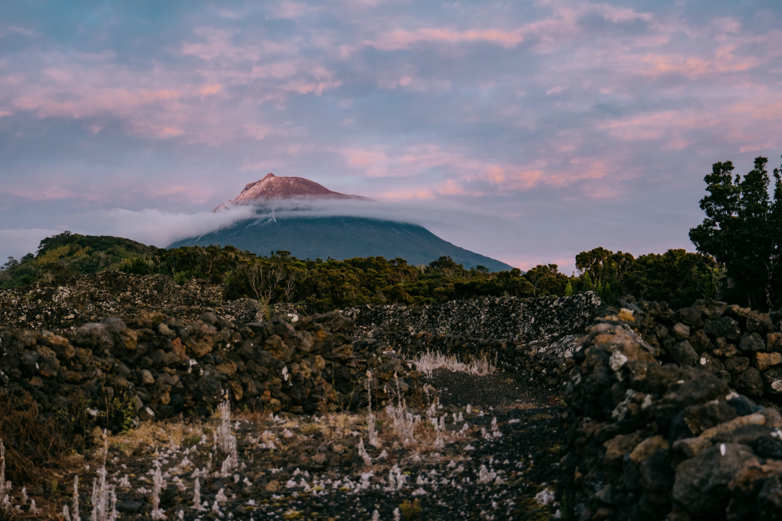
The reason the whole archipelago qualifies is its position on the junction of the North American, Eurasian and African plates. The islands are built from 27 main volcanic systems, 16 of them still considered active, and they display almost every volcanic landform there is: the calderas and twin lakes of Sete Cidades, the stratovolcano of Pico, the boiling fumaroles of Furnas, the lava tube of Algar do Carvão on Terceira, the sulphur cave of Furna do Enxofre on Graciosa, the fossil beds of Santa Maria (the only island with marine fossils) and the Capelinhos volcano on Faial, which erupted from 1957 to 1958 and added new land to the island.
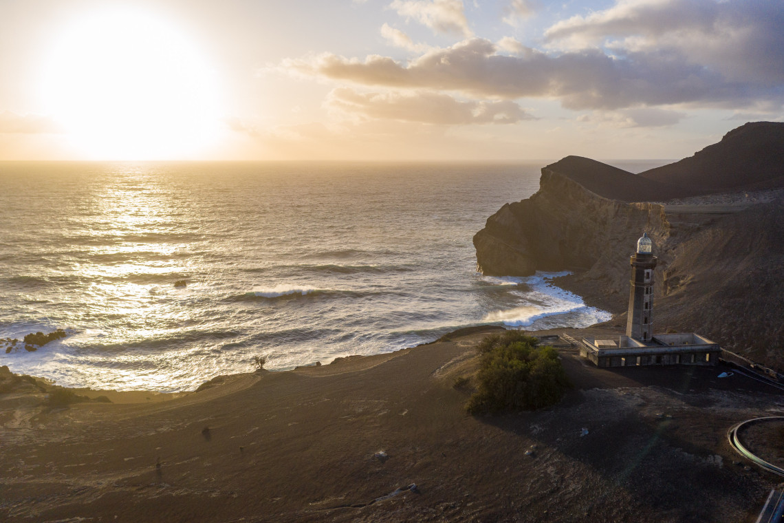
Four interpretation centres explain it: the Capelinhos Volcano Interpretation Centre, built underground beside the ruined lighthouse on Faial; the Furnas Monitoring and Research Centre on São Miguel; the Serra de Santa Bárbara centre on Terceira; and the Dalberto Pombo House of Fossils on Santa Maria. Capelinhos is the one not to miss, and the Geopark has marked geo-routes on every island.
Planning a UNESCO-Themed Trip
The two World Heritage Sites sit on Terceira and Pico, 45 minutes apart by air, and São Miguel is the hub for flights from the US and mainland Portugal, so the natural shape is a three-island trip of nine or ten nights: São Miguel for Sete Cidades and Furnas (Geopark), Terceira for Angra (World Heritage) and Algar do Carvão (Geopark), and Pico for the vineyards (World Heritage), the mountain and, by ferry, Faial's Capelinhos (Geopark). Add São Jorge from Pico by ferry if you want a Biosphere Reserve too, or build a separate western trip to Flores and Corvo.
Angra needs half a day on foot; the Pico vineyards need a morning with a car and an afternoon for the museum and a tasting; Capelinhos needs two hours. None requires tickets in advance except the interpretation centres in high season.
Plan it your way
Custom Your Trip
Tell our local travel advisors which islands, dates and experiences you want and we build the itinerary around you.
Start your custom trip →Limited time
Azores Packages On Sale
Flights, hotels and rental car bundled at reduced prices. See every package currently on sale and book while it lasts.
Book now →Azores UNESCO Sites: FAQ
How many UNESCO World Heritage Sites are in the Azores?
Two: the Central Zone of the Town of Angra do Heroísmo on Terceira, inscribed in 1983, and the Landscape of the Pico Island Vineyard Culture, inscribed in 2004.
Is the whole of the Azores a UNESCO site?
The whole archipelago is a UNESCO Global Geopark, a designation for landscapes of international geological importance. That is different from World Heritage status, which applies only to Angra and the Pico vineyards.
Which Azores islands are UNESCO Biosphere Reserves?
Corvo and Graciosa (both 2007), Flores (2009) and São Jorge, as the Fajãs de São Jorge reserve (2016).
Why is Angra do Heroísmo a World Heritage Site?
Because it was a key Atlantic port of the age of exploration from the 15th to the 19th century and preserves its Renaissance town plan, Baroque churches and two major fortresses, restored after the 1980 earthquake.
Why are the Pico vineyards a World Heritage Site?
Because they are a unique agricultural landscape: vines grown on bare lava inside thousands of small stone-walled enclosures (currais) since the 15th century, together with the wineries, houses and ramps that supported the wine trade.
Can I visit the Pico vineyards and Angra on the same trip?
Yes. Terceira and Pico are a 45 minute flight apart, and both combine easily with São Miguel in a nine or ten night, three-island itinerary.
What is the Azores Geopark?
A UNESCO Global Geopark covering all nine islands and the surrounding seabed, with 121 geosites including Sete Cidades, Furnas, Pico, Algar do Carvão and Capelinhos, and four interpretation centres.
Are there entrance fees for the UNESCO sites?
Angra's historic centre and the Pico vineyard landscape are open places with no fee. Museums and interpretation centres, such as the Pico Wine Museum, Algar do Carvão and the Capelinhos centre, charge admission.