22 September 2026 • 6 min read
Lagoa do Fogo — the Lake of Fire — sits inside a volcanic crater at the centre of São Miguel, at 776 metres above sea level. It is the highest lake on the island and one of the most protected natural areas in the Azores. The view from the road above is reason enough to stop; the hike down to the lake takes around two hours return and ends at a freshwater beach where you can swim.
There is one logistical detail that matters before you plan the visit: from June to September, private cars cannot reach the viewpoint between 9 a.m. and 7 p.m. A shuttle operates from two car parks on either side of the ridge. This page covers the full picture.
The Summer Vehicle Restriction
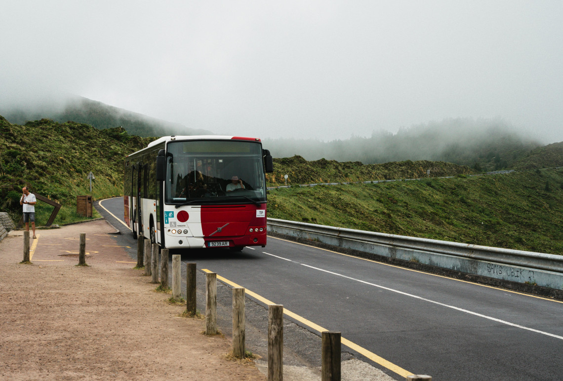
Between 1 June and 30 September, the road to Lagoa do Fogo is closed to private vehicles from 9 a.m. to 7 p.m. This applies every day of the week across the full summer window. During these hours, you must park at one of two shuttle car parks and take the official shuttle bus to the viewpoint area.
Caldeira Velha (northern approach, from Ribeira Grande): The larger and better-signposted of the two. Shuttle tickets are purchased here and the bus runs on a timetable to the viewpoint. Caldeira Velha also has its own thermal pools and is worth visiting as a separate stop on the same day.
Casa da Água (southern approach, from Lagoa town): On the south slope. A smaller car park with the same shuttle service running to the top.
Tickets and departure times for the shuttle are at lagoadofogo.pt. Book online in advance in July and August — shuttle capacity is limited and popular time slots fill up.
Outside the restriction window: Before 9 a.m. and after 7 p.m. in summer, private cars can access the road freely. From October through May there is no restriction at all. Arriving before 9 a.m. is the most practical workaround if you prefer to drive up yourself and also typically gives the best conditions for the viewpoint before cloud builds.
The Viewpoint
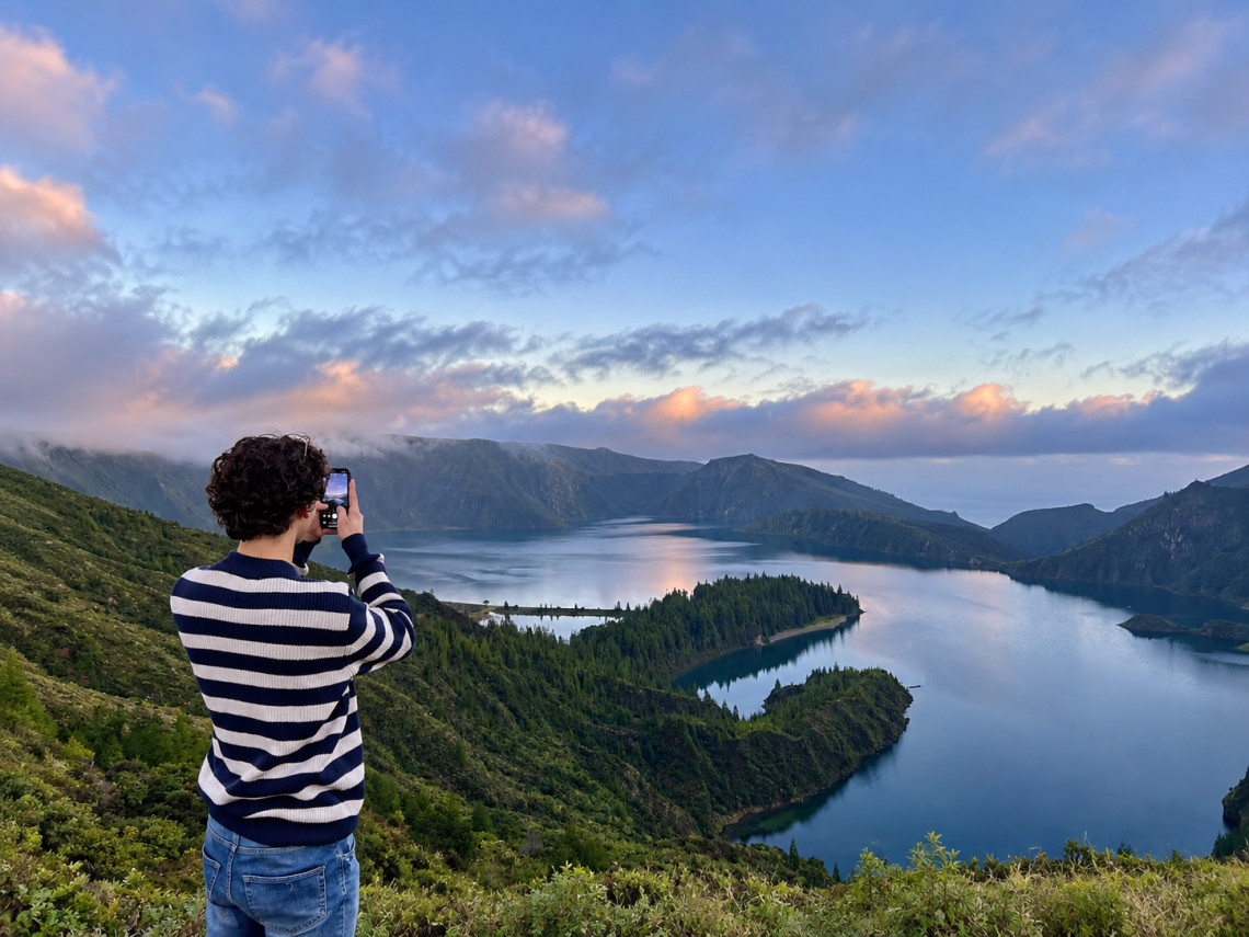
The main viewpoint sits on the road between Caldeira Velha and Casa da Água, at approximately 776 metres. From here the full crater comes into view below: a bowl of dense green vegetation dropping steeply to the lake surface, with the north coast and Atlantic visible beyond the rim on clear days.
The viewpoint is weather-dependent in a way that most visitors underestimate. Lagoa do Fogo clouds over frequently and quickly — the crater fills with mist and the lake disappears entirely. Early morning gives the most reliable clear conditions. By late morning in summer, the probability of cloud increases significantly.
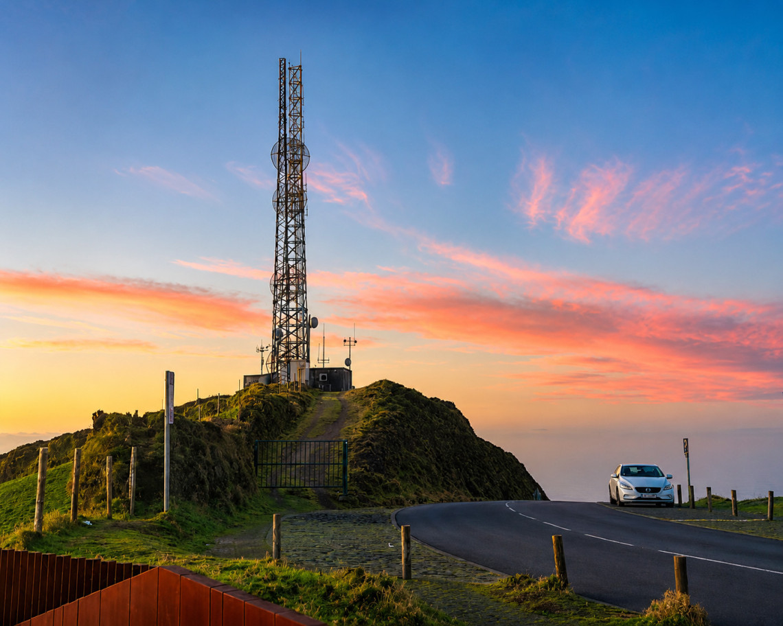
From the viewpoint area, a paved path continues west toward the relay antennas and Pico da Barrosa (947 metres), the second-highest point on São Miguel. The walk to the antenna structures takes about 20 minutes and gives a wider panorama across the island.
The Hike to the Lake
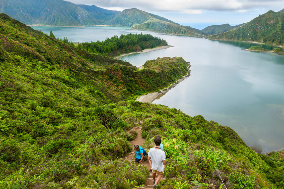
A trail descends from the viewpoint road into the crater and down to the shore of Lagoa do Fogo. The hike is roughly 4 km return and takes between 1.5 and 2.5 hours depending on pace.
The descent is steep in sections on a well-marked but uneven trail through laurisilva forest and open heath. Proper footwear is needed — trail runners or hiking boots. Flip-flops and flat-soled shoes are not appropriate for the steeper parts.
At the lake, a small sandy beach on the northern shore is accessible for swimming. The water is clear and cold — around 17 to 19°C even in summer. Swimming is permitted. There are no facilities at the lake itself; bring water, food, and everything you need for the descent and return.
Allow extra time for the return. The climb back up is more demanding than the descent. In summer heat, this is when unprepared visitors run into difficulty. Start the hike early in the day, before cloud develops and before the temperature peaks.
GUIDED LAGOA DO FOGO HIKE
A guided descent to Lagoa do Fogo crater lake with a local naturalist. The guide handles shuttle logistics and trail navigation — useful if you want to learn about the geology and flora on the way down.
Book Lagoa do Fogo Hike →Getting There
Lagoa do Fogo sits on the ridge between the north and south coasts, roughly in the centre of São Miguel. There are two road approaches:
From Ribeira Grande (north coast): Follow signs to Caldeira Velha. The road climbs south through laurisilva forest. In summer, park at Caldeira Velha and take the shuttle. Outside summer, continue on the same road to the viewpoint.
From Lagoa or Água de Pau (south coast): Follow signs to Casa da Água. A shorter approach from the south side. In summer, park at Casa da Água and take the shuttle.
From Ponta Delgada: Approximately 35 minutes via the south coast approach (through Lagoa), or 45 minutes via Ribeira Grande on the north coast. The Ribeira Grande approach through Caldeira Velha allows you to combine the hot springs with the lake visit on the same day.
What to Combine with Lagoa do Fogo
Caldeira Velha is at the base of the north slope and a natural addition to any Lagoa do Fogo day. The geothermal waterfall and thermal pool (paid entry) is 20 minutes below the shuttle car park. Visit the pools, take the shuttle to the viewpoint, hike to the lake if you want the full experience.
Gorreana and Porto Formoso tea plantations are 15 minutes further north along the coast road. A Lagoa do Fogo morning combined with the north coast tea plantations in the afternoon makes a complete day.
Ribeira Grande town, on the north coast at the base of the ridge, has good lunch options and is a 20-minute drive from Caldeira Velha.
Full guide to São Miguel hiking trails
SÃO MIGUEL VACATION PACKAGES
Packages with flights, hotel, and rental car built by local Azorean experts. The team can advise on the best way to fit Lagoa do Fogo into your itinerary.
See São Miguel Packages →FAQ
Can you swim in Lagoa do Fogo?
Yes. There is a small sandy beach on the northern shore of the lake at the bottom of the hiking trail. Swimming is permitted. The water is clear and cold — around 17 to 19°C even in summer. There are no facilities at the lake, so bring everything you need.
How long is the hike to Lagoa do Fogo?
The round trip from the viewpoint road to the lake and back is roughly 4 km and takes 1.5 to 2.5 hours depending on pace. The descent is steep in sections. The return climb is more demanding than the descent — allow extra time and bring enough water.
Can I drive to Lagoa do Fogo?
From October through May, yes, at any time. From June to September, private cars cannot access the road between 9 a.m. and 7 p.m. During these hours, park at Caldeira Velha or Casa da Água and take the official shuttle. Arriving before 9 a.m. allows private car access and typically offers the clearest viewpoint conditions before cloud builds.
How do I take the shuttle to Lagoa do Fogo?
Shuttle services depart from Caldeira Velha (north side) and Casa da Água (south side). Tickets are purchased and departure times are listed at lagoadofogo.pt. Book in advance in July and August as capacity is limited.
What is the best time of day to visit Lagoa do Fogo?
Early morning, before 9 a.m. This avoids the shuttle restriction, gives the clearest conditions before cloud builds on the crater rim, and is cooler for the hike down. The lake and viewpoint can be completely obscured by cloud from late morning onward, particularly in autumn.
Is the hike to Lagoa do Fogo difficult?
Moderate. The trail is well-marked but steep in sections and uneven underfoot. Trail shoes or hiking boots are necessary; flat soles and sandals are not suitable for the steeper descent. The return climb is harder than going down. Not suitable for visitors with significant mobility limitations, but manageable for anyone with reasonable fitness.